Real time satellite imaging

KsRancher

WKR
Joined
Jun 6, 2018
Messages
714
I seen a thread on here a while back and someone posted a link to a website that showed real time satellite images. I think it was on a thread about snow pack or something like that. Anyone remember that thread? Or have a good website with good images in real time.

Thanks
 

def90

WKR
Joined
Aug 12, 2020
Messages
1,714
Location
Colorado
Real time sat images are probably easy to find in regards to zoomed out images. If you are looking for real time zoomed in images with any kind of detail there are commercial companies that sell that for a fair amount of $$.
 
OP
KsRancher

KsRancher

WKR
Joined
Jun 6, 2018
Messages
714
Thanks guys. I was thinking you could zoom in pretty good with this one. Wanting to see where the snow is in the days leading up to Colorado first rifle
 
Joined
Sep 2, 2015
Messages
502
The On X recent imagery (approx 2 weeks) tool is plenty accurate enough and clear enough to detect significant snowfall and likely receding snow conditions in spring (though I haven't had a chance to use it for that yet) . I've also used it as a confirmation tool to ensure the timber patches I want to hunt haven't been thinned/logged.

Doubt you'd use it for small significant land marks (specific rocks or trees) or even herds of animals, but for relatively recent snow falls, abnormally higher rainfall detection (larger greener areas than normal), or existing timber stands, I find it helpful.
 

elkivory

FNG
Joined
Apr 30, 2023
Messages
67
Location
Boerne, Texas
The On X recent imagery (approx 2 weeks) tool is plenty accurate enough and clear enough to detect significant snowfall and likely receding snow conditions in spring (though I haven't had a chance to use it for that yet) . I've also used it as a confirmation tool to ensure the timber patches I want to hunt haven't been thinned/logged.

Doubt you'd use it for small significant land marks (specific rocks or trees) or even herds of animals, but for relatively recent snow falls, abnormally higher rainfall detection (larger greener areas than normal), or existing timber stands, I find it helpful.
The recent imagery tool must be for elite users only? I have basic OnX just for Colorado and don't seem to have this feature.
 

Carr5vols

WKR
Joined
Apr 12, 2019
Messages
1,370
Location
West Georgia
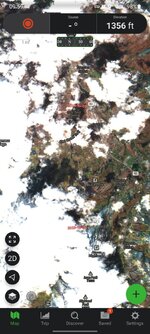
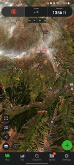
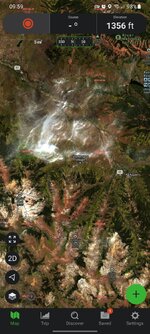
Herr some examples of Gaia. First is a layer called represent. Next two are layers called cloud free...you can decent zoom. For the money Gaia cant be beat...Screenshot_20231007_095952_Gaia GPS.jpgScreenshot_20231007_095923_Gaia GPS.jpgScreenshot_20231007_095905_Gaia GPS.jpg
 

98045

FNG
Joined
Aug 14, 2014
Messages
23
You can check out CalTopo as well. Need the pro account to get daily sat images I believe. Great for hunting, skiing and peakbagging adventures. 50 bucks a year I think but you can save maps offline and such. Powerful tool.


Sent from my iPhone using Tapatalk
 

uglymud

FNG
Classified Approved
Joined
Aug 30, 2020
Messages
52
Location
SW, CO
I use sentinel hub, a little finicky at first but they typically have satellites passing over an area every few days.

Sent from my SM-S908U using Tapatalk
 
Joined
Jul 7, 2021
Messages
44
This is the one. Satellite images updated daily. Suitable for determining snow extent. Not good enough resolution for escouting, though.

 
Joined
Apr 13, 2019
Messages
549
Listening to a podcast today, sounds like onX is offering custom imagery requests, haven’t looked to see what the price tag is but they said you pick what you want, send the request and they get the imagery in a few days and it’s part of your layering.
 
Top