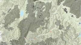
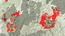
This coming week actually looks OK for fires. But, who knows.Well, some possible good news: a cold front is predicted to move in on Wednesday and we might get a steady rain for a few hours with no lightning.
Navigation
Install the app
How to install the app on iOS
Follow along with the video below to see how to install our site as a web app on your home screen.
Note: This feature may not be available in some browsers.
More options
Style variation
You are using an out of date browser. It may not display this or other websites correctly.
You should upgrade or use an alternative browser.
You should upgrade or use an alternative browser.
Idaho fires
- Thread starter Rotnguns
- Start date
Frog fire is blowing up here in Custer County and has prompted trailhead closures and mandatory evacuations. Tomorrow could be a busy day on that fire, I'll post up pics of it from the ranch tomorrow. We're waiting on that rain coming Thursday, but high winds forecast from now til then. So far it's moving away from us, but could block us in pretty quick.
Sent from my SM-S918U using Tapatalk
Sent from my SM-S918U using Tapatalk
Rotnguns
WKR
Good heavens, those are dramatic pictures. I hope you and your family are ok. That fire looks like it's pretty close.Progression of the fire over the past 90 minutes. Air tankers been dropping since early this morning


Sent from my SM-S918U using Tapatalk
Thanks for sharing - love that area! Is this showing a blow-up in the last 90 minutes? Keeping a close eye on things here and piecing together information from different sources...Progression of the fire over the past 90 minutes. Air tankers been dropping since early this morning


Sent from my SM-S918U using Tapatalk
It started the day about 1500 acres, but it's grown all day. Jumped the East Fork now so it's going to potentially lead to more area closures. Anyone with a Pioneer zone tag should be keeping a keen eye. OnX is showing the hot spots and you can track the progress of the fire movement.Thanks for sharing - love that area! Is this showing a blow-up in the last 90 minutes? Keeping a close eye on things here and piecing together information from different sources...
Sent from my SM-S918U using Tapatalk
Bigbuckbandit
FNG
Appreciate the local report. Idaho Fish and Game also has a great GIS map that shows fire perimeter, satellite hotspots, and trail closures. Just google Idaho Fish and Game Fire Map and it should be the first result.It started the day about 1500 acres, but it's grown all day. Jumped the East Fork now so it's going to potentially lead to more area closures. Anyone with a Pioneer zone tag should be keeping a keen eye. OnX is showing the hot spots and you can track the progress of the fire movement.
Sent from my SM-S918U using Tapatalk
We’re hurting bad for rain in all of Idaho. Looks like tomorrow should bring some and hopefully help with containment on these fires.
I’m insanely jealous that you have a ranch out there on the East Fork. Praying you and your property remain safe and the fire fizzles out once the humidity ramps up.
.204smokechaser
WKR
Tides might be turning for some fires this year with precipitation coming in, but if none of you have seen the damage from the windstorm up the Selway or Lochsa this year, I fear we could have a really bad one in the next few years with all the timber that’s laying on the ground and still hung up in other trees.
The lochsa and north fork are badly in need of a burn to clean them outTides might be turning for some fires this year with precipitation coming in, but if none of you have seen the damage from the windstorm up the Selway or Lochsa this year, I fear we could have a really bad one in the next few years with all the timber that’s laying on the ground and still hung up in other trees.
The selway has burned a bunch in the past decade and has some good ones going now. I suspect the Wye and macgruder fires in there are burning up a bunch of recent windfall
Rotnguns
WKR
Cold front moving into southern Idaho from the west today. Thunderstorms and high winds possible - hope they bring rain along with them. Supposedly more rain in a few more days.
It’s raining hard just west of the Wapiti fire. It should help with getting the fire under control.Cold front moving into southern Idaho from the west today. Thunderstorms and high winds possible - hope they bring rain along with them. Supposedly more rain in a few more days.
jimh406
WKR
I hope the storms coming through just drop rain and no lightning.
CamoPirate
WKR
There's been minimal lightning so far; the rain has been pretty good so far. Should help make it sound like I'm not walking in a Frito Lay factory that laid off QC...
bisblue
WKR
Rotnguns
WKR
Thanks for posting this - that's a great map and overlay. May I ask what software was used?Older data, but this shows some historic vs current fires in the Lowman and garden valley areas. View attachment 763021View attachment 763022
Customweld
WKR
This is the one I use. It used to have each fire year color coded. It looks like they changed that.Thanks for posting this - that's a great map and overlay. May I ask what software was used?

InterAgencyFirePerimeterHistory All Years View
Interagency Wildland Fire Perimeter History (IFPH) includes perimeters thru 2024 fires, update complete 7/5/2025. Data maintained by the Wildland Fire Management Research, Development, & Application program data team: [email protected]
data-nifc.opendata.arcgis.com
Rotnguns
WKR
Say, that's a great resource and it's free. Thanks for the link!This is the one I use. It used to have each fire year color coded. It looks like they changed that.

InterAgencyFirePerimeterHistory All Years View
Interagency Wildland Fire Perimeter History (IFPH) includes perimeters thru 2024 fires, update complete 7/5/2025. Data maintained by the Wildland Fire Management Research, Development, & Application program data team: [email protected]data-nifc.opendata.arcgis.com
Customweld
WKR
When you look at that map, you realize that there isn't much of Idaho that hasn't been burnt.Say, that's a great resource and it's free. Thanks for the link!
bisblue
WKR
I'll double check later, a fire planner at work shared it with me.
I was working the snag, Boulder and goat fires. I think the only spot that has burned in those fire areas was in 1908.
I was working the snag, Boulder and goat fires. I think the only spot that has burned in those fire areas was in 1908.
Similar threads
- Replies
- 55
- Views
- 3K
- Replies
- 169
- Views
- 5K
- Replies
- 83
- Views
- 6K
Featured Video
Latest Articles
- TT#64 Josh Boyd Elk Hunting Strategies for Every Season
- Aaron Davidson of Gunwerks
- TT#63 Dirk Durham’s Art of Elk Calling
- BIG Buck Stories with the Dirty Giants Podcast
- TT#62 Brian Barney Hunting Bulls without Calling
- Hoyt Alpha AX-2 SD Review
- Kuiu Kenai vs Outdoor Vitals Vario Hooded Jacket Review
- Hoyt RX-9 Ultra Review
- Hunting Vampire Bucks & Building an Optics Kit
- Darton Sequel ST2 35 Review


