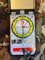
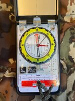
True North or Magnetic North?

Joined
Jul 30, 2015
Messages
6,339
Location
Lenexa, KS
Um. Be careful saying it doesn't matter. Depending on where you are in the us the difference can be 20* or more. if you are navigating with a map and compass that can mean a big difference in what azimuth you shoot vs what you follow.

not to get all mathy, but if for example you are in western Washington and you want to go 1 mile due north, if you took a magnetic compass heading of 0* and walked a mile, you would end up 1/3 of a mile to the east of where you want to be.

if none of that makes sense, google “declination navigation” and read a few of the how to‘s.


View attachment 544638

All I meant was, with an iPhone, and I assume any other electronic compass on a phone (the OP referenced app), the inherent accuracy and repeatability are such shit that you could choose true or magnetic and not be able to tell the difference.

I agree with a real compass it can matter.
 
Joined
Nov 16, 2017
Messages
8,884
Location
Central Oregon
I believe most US TOPO maps will list the declination at the bottom. I was stationed at Ft. Campbell, KY. We were told not to worry about the declination. And if you look at the above map I may have been around 1* W??
Were you all LT's ?
They figured you'd just get lost any ways😲
 

Hnthrdr

WKR
Joined
Jan 29, 2022
Messages
3,607
Location
The West
Were you all LT's ?
They figured you'd just get lost any ways😲
Can’t spell lost without LT right ;) I’ve gotten a little lazy since Georgia’s school for lost boys, but I also hunt a lot of places that I know really well, hell mountains are cake to navigate in compared to forested flatlands or swamps, terrain features galore. Gotta keep at least one compass just in case though
 
Joined
Nov 27, 2013
Messages
1,952
This doesn’t even make sense in my mind from a user experience, none. Who uses onx along with a paper type map? I’d venture to say nobody.

Set compass in phone to true, and you’ll be close enough to match what onx is telling you. At least the way the majority of people are using it.
 
Last edited:
Joined
Apr 5, 2015
Messages
5,947
This doesn’t even make sense in my mind from a user experience, none. Who uses onx along with a paper type map? I’d venture to say nobody.

Set compass in phone to true, and you’ll be close enough to match what onx is telling you. At least the way the majority of people are using it.

I do. I am a bit old school, but when I go into the big woods I typically have my phone, a backup GPS (etrex), a decent paper map, a decent compas and a button compass back up. GPSs have gotten a lot better and smaller in the 30 years I have used them but I still like having a map.

i primarily navigate using Gaia, but I like to have and occasionaly reference the paper map. although in fairness, I rarely plot or follow azimuths these days. I take a general heading and adjust based on where the GPS says I am.
 
Joined
Nov 27, 2013
Messages
1,952
I take a general heading and adjust based on where the GPS says I am.
Exactly! hence the question, who is taking a reading on their GPS, then looking at a map, and applying the magnetic declination when they're following a line gvien to them via GPS? That's right, nobody!
 
OP
cnelk

cnelk

WKR
Joined
Mar 1, 2012
Messages
7,551
Location
Colorado
Lets back up a bit...

I never mentioned a map, not sure where that was inserted.

I will be putting in a half mile of fence - thru the woods - with a survey point at each end.

True North or Magnetic North to connect the two points?

[ A surveyor already told me how to do it, just seeing what The 'Rokslide' says ;) ]
 

Dwight2180

Lil-Rokslider
Joined
Jan 25, 2021
Messages
129
Lets back up a bit...

I never mentioned a map, not sure where that was inserted.

I will be putting in a half mile of fence - thru the woods - with a survey point at each end.

True North or Magnetic North to connect the two points?

[ A surveyor already told me how to do it, just seeing what The 'Rokslide' says ;) ]
I've tried this before with a phone. I have android and have no idea if I can select which method it uses, but I think its true. I live in a 0-1 declination area. Here's what I did....I marked both ends of the fence on a gps app. I made sure the map was set to north up and "navigated to point" so the line was the screen. I put one point in the center of the phone and aligned a compass over the top. I took a reading of the line over the top and used that to get started. I used the compass to walk and mark the line...the phone was never accurate.
 
Joined
Jan 30, 2019
Messages
736
Location
Wisconsin
Um. Be careful saying it doesn't matter. Depending on where you are in the us the difference can be 20* or more. if you are navigating with a map and compass that can mean a big difference in what azimuth you shoot vs what you follow.

not to get all mathy, but if for example you are in western Washington and you want to go 1 mile due north, if you took a magnetic compass heading of 0* and walked a mile, you would end up 1/3 of a mile to the east of where you want to be.

if none of that makes sense, google “declination navigation” and read a few of the how to‘s.


View attachment 544638
I like the way the 'Red line of Perfection' goes right through the center of Wisconsin!
The way God intended. 😇
 

nodakian

WKR
Rokslide Sponsor
Joined
Aug 24, 2017
Messages
638
Location
Dickinson, ND
Lets back up a bit...

I never mentioned a map, not sure where that was inserted.

I will be putting in a half mile of fence - thru the woods - with a survey point at each end.

True North or Magnetic North to connect the two points?

[ A surveyor already told me how to do it, just seeing what The 'Rokslide' says ;) ]
If you are running a section line or roughly parallel or perpendicular, true north will be closer. Surveyors, especially in the western US, typically don't use magnetic. The old timers checked the "variation of the needle" while sighting Polaris, then applied that variation, aka declination, while running lines. The result was directions being more or less true relative to geodetic/true/north pole north.

Did I pass the quiz?
 
Joined
Nov 27, 2013
Messages
1,952
Lets back up a bit...

I never mentioned a map, not sure where that was inserted.

I will be putting in a half mile of fence - thru the woods - with a survey point at each end.

True North or Magnetic North to connect the two points?

[ A surveyor already told me how to do it, just seeing what The 'Rokslide' says ;) ]
Well if a surveyor marked it off, I hope he marked it all the way through as using Onx to put a fence in, with a "compass" is about as Beverley Hillbilly as it gets. I hope you have a national forest as a neighbor.

So, the real question is, did he give you an azimuth between the two points? Or a bearing? What did he base it on? A known grid such as UTM? Now you just introduced yet another form of "Azimuth" Knowing what is done in CO, and most likely WY, he referenced True North.
 

dutch_henry

Lil-Rokslider
Joined
Mar 5, 2018
Messages
262
Location
Vermont
I believe most US TOPO maps will list the declination at the bottom. I was stationed at Ft. Campbell, KY. We were told not to worry about the declination. And if you look at the above map I may have been around 1* W??
They do, but declination also shifts over time so it's often out of date. There are websites with the current values like https://www.ngdc.noaa.gov/geomag/calculators/magcalc.shtml and https://www.magnetic-declination.com/
According to them, Campbell, KY is now 6.6 degrees west.

I like trying to be accurate, but I don't think a few degrees has ever made a difference for my use.
 
Joined
Nov 27, 2013
Messages
1,952
They do, but declination also shifts over time so it's often out of date. There are websites with the current values like https://www.ngdc.noaa.gov/geomag/calculators/magcalc.shtml and https://www.magnetic-declination.com/
According to them, Campbell, KY is now 6.6 degrees west.

I like trying to be accurate, but I don't think a few degrees has ever made a difference for my use.
If putting 1/2 mile fence in WY, he better worry. There is a big difference between true and magnetic. As in, 500+ feet difference @ 1/2 mile. Classic case of Onx surveyors.
 

Hnthrdr

WKR
Joined
Jan 29, 2022
Messages
3,607
Location
The West
This whole thread should make some people realize that reliance on electronic devices is way too extreme. It’s all a crutch, analog capability to navigate is important especially in new/unfamiliar territory
 
OP
cnelk

cnelk

WKR
Joined
Mar 1, 2012
Messages
7,551
Location
Colorado
This is what my surveyor friend suggested, and what I'll do.


[True or Magnetic] It will probably matter but I'm not sure which is best, probably true north. I recommend you run a random line and correct back like the surveyors did in the old days.

What you do is choose a north heading and keep pushing that line as perfectly straight as you can marking it with flagging as you go. It doesn't matter if you hit the second corner with your line, you just want to push the line as straight as possible. It will help if you pull a 100' tape measure or shoot the distance to each piece of flagging with a rangefinder and write the total distance traveled on each piece of flagging with a sharpie.

Then when you get to the other corner, the line you pushed will miss that corner on one side or the other. So let's say for example you measured 2600' and the line you pushed ended up 30' west of the second corner. So then you know that the straight line you pushed and flagged was deviating to the west of the true line. So now you can go back and move all the flagging the proportionate amount to the east to be approximately on the true line. That's why writing the distance on the flagging helps because you can figure out the proportion. It's just a straight proportion 30/2600 = x/distance measured. With x being the correction offset. So let's say for example you have flagging at 425' up the line, cross multiply and divide to determine the offset: 30/2600 = x/425. x = 4.9 feet.
 

ODB

WKR
Joined
Mar 24, 2016
Messages
4,030
Location
N.F.D.
This is what my surveyor friend suggested, and what I'll do.


[True or Magnetic] It will probably matter but I'm not sure which is best, probably true north. I recommend you run a random line and correct back like the surveyors did in the old days.

What you do is choose a north heading and keep pushing that line as perfectly straight as you can marking it with flagging as you go. It doesn't matter if you hit the second corner with your line, you just want to push the line as straight as possible. It will help if you pull a 100' tape measure or shoot the distance to each piece of flagging with a rangefinder and write the total distance traveled on each piece of flagging with a sharpie.

Then when you get to the other corner, the line you pushed will miss that corner on one side or the other. So let's say for example you measured 2600' and the line you pushed ended up 30' west of the second corner. So then you know that the straight line you pushed and flagged was deviating to the west of the true line. So now you can go back and move all the flagging the proportionate amount to the east to be approximately on the true line. That's why writing the distance on the flagging helps because you can figure out the proportion. It's just a straight proportion 30/2600 = x/distance measured. With x being the correction offset. So let's say for example you have flagging at 425' up the line, cross multiply and divide to determine the offset: 30/2600 = x/425. x = 4.9 feet.

Awesome. I love surveying stuff. Not sure why. Neat.
 
Joined
Jan 6, 2023
Messages
75
As a land surveyor, what you are doing works in theory. I would strongly recommend using an actual magnetic compass and not a phone. In your example declination is irrelevant to the final outcome. I think it's a bold move for half a mile, but I wish you luck.
 
Top