BLM access OnX

Joined
Apr 28, 2021
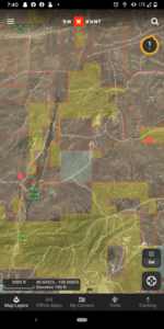
I'm e scouting a new area for this fall and I was curious if anyone had a way to determine if a two track that leaves a main highway and crosses through a mix of BLM and private land is publicly accessible to drive on to access the BLM parcels

Thanks for the assistance
 
Way I understand it, the road has to be marked(FS rd, County rd, etc) on map, otherwise it's a private road.
 
Way I understand it, the road has to be marked(FS rd, County rd, etc) on map, otherwise it's a private road.
Is there a feature on some application or OnX that shows that information? So this area here is just for illustrative purposes, I'm not necessarily trying to hunt here or put any area on blast...

Would it be possible to travel between these two red dots along what shows up as a two track? Is there a way to find out if a given dirt road here is public?
 

Attachments

  • Screenshot_20210730-194014.png
    Screenshot_20210730-194014.png
    1.4 MB · Views: 58
I would say likely not. In Montana, I use Cadastral to see if the road shows up as a county road. I would bet that the solid line roads are all that you can travel on that example. Two tracks are likely ranch access roads.
 
Colorado counties are pretty good at having an online map that tells you who maintains the road and if it’s open for public travel

if I had to bet money, it is a private road and no public access
 
Like everyone said double check all roads you see on OnX unless it’s obviously a public road. The OnX layers note if a road/or two track is on public land but that doesn’t mean you can legally use them if they cross private
 
Whenever I get in this spot i do two things, check with the county.....and the game warden. Go to the source of the ticket for grace.
 
Back
Top