jtivat
Lil-Rokslider

Same area on google maps.
Follow along with the video below to see how to install our site as a web app on your home screen.
Note: This feature may not be available in some browsers.
@jtivat - I have found the most up-to-date imagery is often on Apple's "Find My" app. The imagery there is often more recent than the imagery used in either Google Maps or Apple's Maps, for whatever reason. It does not always render as clearly as the other two, though. In some cases, it does, others not. Just another source to check out.Have you tried using google Maps? The satellite view

It is an app on the iPhone. I imagine you'd have to get it from the Apple store. it is called "Find My" and is used to find other iphone users. You can add family and friends, but don't have to. Just find your location, zoom in and out, and pan around. Only works on iPhone (or other apple devices).Do you have a link when I search find my i just get find my iPhone.
Holycrap so you are talking just the iPhone "Find my iPhone" app I have it already and look at this! This is a much newer image why would they not have this on their regular maps program?It is an app on the iPhone. I imagine you'd have to get it from the Apple store. it is called "Find My" and is used to find other iphone users. You can add family and friends, but don't have to. Just find your location, zoom in and out, and pan around. Only works on iPhone (or other apple devices).

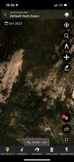
Click on the attached pics. One is Oct, other is Dec. same locationthats Not true. I just checked Huntstand for my area, It has the same satellite imagery as GAIA. Images are from about 5 years ago.
You are welcome! (And, yes, you reminded me, the “Find My” is a default app built into the iPhone.). For whatever reason the imagery is different and more up to date than some of the other mapping applications available. (For some interesting views, use the “Find My” app and pan over to a large city like New York City. The 3D views are quite something!). In any event, have a great hunt this fall. Good luck!Seriously thanks this is a game changer I already found like four promising clear cuts for birds! Very excited for September!
I have no idea what those pics are.... All I know is that everywhere I check in WY on huntstand is they have the exact same images I have on GAIA which is the same images as google maps and they are all at-least 4 years old or older.HuntStand has monthly updated photos.
Click on the attached pics. One is Oct, other is Dec. same location
Ya, I think I found that in one of the apps also, but it was so low rez I could not see what I needed.I have no idea what those pics are.... All I know is that everywhere I check in WY on huntstand is they have the exact same images I have on GAIA which is the same images as google maps and they are all at-least 4 years old or older.
Update,,,I think i found what you are talking about. It is called monthly sat or something like that. GAIA has a siimilar feature called freshsat. They are both lower resolution overlays that are updated more frequently but not as clear as the main imagery map overlay.
I zoomed in on the image, made it blurry. with Huntstand you can pick the month you would like to look at. W GAIA you can only look at current.I have no idea what those pics are.... All I know is that everywhere I check in WY on huntstand is they have the exact same images I have on GAIA which is the same images as google maps and they are all at-least 4 years old or older.
Update,,,I think i found what you are talking about. It is called monthly sat or something like that. GAIA has a siimilar feature called freshsat. They are both lower resolution overlays that are updated more frequently but not as clear as the main imagery map overlay.
That is cool but depending on the area it is not correct. For instance, at my home, it is more up to date the "Find my" but in the example I used above it never shows the clearcut area. It shows an image for 01-06-2022 but it is not correct or any different than the other previous images.This is another free source of imagery to check out. https://livingatlas.arcgis.com/wayback/#active=11475&ext=-115.32094,35.98162,-115.21451,36.16477
Definitely check that box that says "only versions with local changes".