School me on Kestrel Units

Formidilosus

Super Moderator
Shoot2HuntU
Joined
Oct 22, 2014
Messages
10,119
Roger. I see that it's one number not two like I use (temp and station pressure), but I don't understand how you're estimating pressure without a meter. I can guess temp and altitude pretty well, but not pressure. I can just stand by for your video; looking forward to it.

The bullet does not care where it’s actually at on the earth, only where is “feels” that it’s at- that means actual pressure. To generate that in a ballistics program, you generally put in altitude, BP, temperature, and humidity (leave at 50%) which converts all that “pressure”. Density altitude is pressure altitude corrected for a different temperature- I.E. where a bullet “feels” it’s at.

You need two things to get DA- temp and altitude in feet above sea level.

For instance

I guessed at 75° just based on how it felt today and 3,500ft ASL due to a rough guess based on my knowledge of the area. Below is the chart- find actually temp, go up the slanted lines until actual altitude, the go 90° left to read DA.


Doing that I read 5,100ft DA.

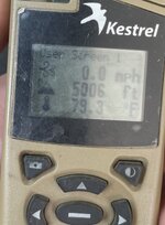
The actual was-

3,056ft and 79°

For a DA of 5,006 foot.
0D735DCE-91AD-4BF1-A80A-B39CF30A6655.jpeg


It takes my 6.5 cm and 130gr TMK 1,800 yards to change the data .1 mil between 5k DA and 5100ft DA.
 
OP
N

nobody

WKR
Joined
Sep 15, 2020
Messages
2,112
I guessed at 75° just based on how it felt today and 3,500ft ASL due to a rough guess based on my knowledge of the area. Below is the chart- find actually temp, go up the slanted lines until actual altitude, the go 90° left to read DA.
PERFECT! Thank you sir!

So, if we understand correctly:

Slanted lines (Pressure altitude, as labeled) = actual altitude above sea level

So the horizontal line that intersects with the intersection of the actual altitude (slanted line) and the temperature (vertical line) is the density altitude.

Yes?

Sorry to everyone for the questions, but not that sorry, as I'm the one who started the thread.
 

Formidilosus

Super Moderator
Shoot2HuntU
Joined
Oct 22, 2014
Messages
10,119
PERFECT! Thank you sir!

So, if we understand correctly:

Slanted lines (Pressure altitude, as labeled) = actual altitude above sea level

So the horizontal line that intersects with the intersection of the actual altitude (slanted line) and the temperature (vertical line) is the density altitude.

Yes?

Correct.
 

Formidilosus

Super Moderator
Shoot2HuntU
Joined
Oct 22, 2014
Messages
10,119
Love it. No additional electronics needed, idiot proof. Just what a mouth breather like me needs. Thank you!

Of course.

Electronics are great, but I don’t want them to be a single source of failure. I have a hard data card set at 5,000ft DA, and usually one at 0ft and 10k ft while hunting, a small thermometer, a DA chart, and a mil range cheat sheet on me. Sometimes I’ll do data cards in 2k Ft intervals depending on situation.
They are like an ounce all together and with them I need zero electronics to make shots. In the last three years I have had to use the chart to pull DA as the Kestrel died in the cold, the data chart for elevation, and flash mil elk in a blowing snowstorm for my buddy to shoot- which he did.
 

Harvey_NW

WKR
Joined
Feb 13, 2019
Messages
1,956
Location
WA
Yeah this is good sh*t. Screenshotting the drop table and making it your lock screen is brilliant.
 

id_jon

WKR
Joined
Oct 6, 2018
Messages
682
Location
ID
If you still want a weather meter, the kestrel 2500 is pretty cheap. Gives you wind speed, temp, altitude, and wind chill. I have gotten much better at wind reading just by carrying it around when I'm outside, estimate wind speed, and then check with the kestrel. Obviously much of wind skill is figuring out angle and topographical effects, but if you can get to where you have a good feel for what certain wind speeds feel like, then that really helps take some mental strain away.
 
OP
N

nobody

WKR
Joined
Sep 15, 2020
Messages
2,112
Of course.

Electronics are great, but I don’t want them to be a single source of failure. I have a hard data card set at 5,000ft DA, and usually one at 0ft and 10k ft while hunting, a small thermometer, a DA chart, and a mil range cheat sheet on me. Sometimes I’ll do data cards in 2k Ft intervals depending on situation.
They are like an ounce all together and with them I need zero electronics to make shots. In the last three years I have had to use the chart to pull DA as the Kestrel died in the cold, the data chart for elevation, and flash mil elk in a blowing snowstorm for my buddy to shoot- which he did.
I'm a believer in simplicity in my system. The less dinking around a guy can do in the heat of the moment the better. We, as humans, have a tendency to make things far more difficult than they need to be. But beyond that, we tend to place an emphasis on the wrong things (IE placing a higher emphasis on equipment rather than on practice, as an example). That said, I'm also a believer in NEVER having your equipment be your limiting factor. If you don't take the shot at the animal, the reason you don't should be because you aren't capable, not because your equipment isn't capable or has let you down. I was willing to spend the money on a Kestrel to make sure I truly can be just that much more capable in field, but seeing a simpler way that eliminates all the dinking around is a no brainer. Since I started improving my confidence at distance the last few years, I've done the same thing as you and set my drop table as my screen saver during the season.

I think I'll add the data card backups to my arsenal this season as well as you mention above. No real weight added, and it can only help when things go south. Again, thank you sir.
 

BjornF16

WKR
Joined
Dec 12, 2019
Messages
2,626
Location
Texas
@Formidilosus arent you supposed to parallel the standard temperature line?

Edit: N/M…I was thinking different aviation chart.

You are absolutely correct
 
Last edited:

Antares

WKR
Joined
Jan 13, 2021
Messages
2,084
Location
Alaska
The bullet does not care where it’s actually at on the earth, only where is “feels” that it’s at- that means actual pressure. To generate that in a ballistics program, you generally put in altitude, BP, temperature, and humidity (leave at 50%) which converts all that “pressure”. Density altitude is pressure altitude corrected for a different temperature- I.E. where a bullet “feels” it’s at.

You need two things to get DA- temp and altitude in feet above sea level.

For instance

I guessed at 75° just based on how it felt today and 3,500ft ASL due to a rough guess based on my knowledge of the area. Below is the chart- find actually temp, go up the slanted lines until actual altitude, the go 90° left to read DA.


Doing that I read 5,100ft DA.

The actual was-

3,056ft and 79°

For a DA of 5,006 foot.

View attachment 555143


It takes my 6.5 cm and 130gr TMK 1,800 yards to change the data .1 mil between 5k DA and 5100ft DA.

That's great! I follow all that fine. Thanks!

I don't understand how fluctuations in barometric pressure are handled though. Do you just ignore it?

That's why I use temp and station pressure. Station pressure is combination of altitude and barometric pressure or as you put it, what the bullet "feels." I don't see how that's taken into account in your method. Does it just not matter that much? Thanks again.
 

Formidilosus

Super Moderator
Shoot2HuntU
Joined
Oct 22, 2014
Messages
10,119
That's great! I follow all that fine. Thanks!

I don't understand how fluctuations in barometric pressure are handled though. Do you just ignore it?

That's why I use temp and station pressure. Station pressure is combination of altitude and barometric pressure or as you put it, what the bullet "feels." I don't see how that's taken into account in your method. Does it just not matter that much? Thanks again.

Barometric pressure is altitude and temperature. You have standard pressure at “x” altitude, changes in temperature change pressure. DA uses standard pressure at altitude, with a correction for temperature.

Look at the DA chart- 59° and 0ft of altitude is sea level (or a BP of 29.92) The sliding scale is doing the math for you.
 

Antares

WKR
Joined
Jan 13, 2021
Messages
2,084
Location
Alaska
Barometric pressure is altitude and temperature.

Huh, I guess I learned something today, but I'm still confused about how that can be true.

I live at sea level. I can have a high pressure system that makes for clear, bluebird weather regardless of whether it's 20F of 60F and I can have a low pressure system that makes for stormy, windy weather in the same temperature range. What am I missing? I'm feeling stupid.
 

Formidilosus

Super Moderator
Shoot2HuntU
Joined
Oct 22, 2014
Messages
10,119
Huh, I guess I learned something today, but I'm still confused about how that can be true.

I live at sea level. I can have a high pressure system that makes for clear, bluebird weather regardless of whether it's 20F of 60F and I can have a low pressure system that makes for stormy, windy weather in the same temperature range. What am I missing? I'm feeling stupid.

Are you looking corrected pressure to standard? Anytime BP goes up or down, temperature changes. But it won’t look like it if you use, or are getting corrected pressure. Anytime you get a barometric pressure from the news or a weather station it is corrected.


From a couple of weather sites-


Sea Level Pressure
The sea level pressure is the atmospheric pressure at sea level at a given location. When observed at a reporting station that is not at sea level (nearly all stations), it is a correction of the station pressure to sea level. This correction takes into account the standard variation of pressure with height and the influence of temperature variations with height on the pressure. The temperature used in the sea level correction is a twelve hour mean, eliminating diurnal effects. Once calculated, horizontal variations of sea level pressure may be compared for location of high and low pressure areas and fronts.
However, meteorologists correct the barometer value to give the pressure reading at sea level instead of at your current elevation. This is because pressure is also useful for determining pressure systems. A barometer value above 29.92 inHg is a high pressure system and usually means air is cooling, humidity is decreasing, and the pressure of that air is stabilizing the atmosphere. A barometer reading below 29.92 inHg is a low pressure system and usually means air is warming and humidity is increasing. Low pressure systems tend to bring clouds, rain and snow storms. High pressure systems tend to bring clear skies and a calm atmosphere.


and-


Pressure at different altitudes​

Historically, barometer correction (density altitude) was used in conjunction with mercury-based meters. The temperature affects the readings. Knowing the temperature value would help scientists correct the values on barometers to give a more accurate reading of the pressure.
 

Antares

WKR
Joined
Jan 13, 2021
Messages
2,084
Location
Alaska
Are you looking corrected pressure to standard? Anytime BP goes up or down, temperature changes. But it won’t look like it if you use, or are getting corrected pressure. Anytime you get a barometric pressure from the news or a weather station it is corrected.


From a couple of weather sites-


and-


Yeah, I don't see anything wrong with what your saying. I'm just getting my mind blown here. How is it with all the external ballistics content I've consumed, I've never seen it laid out as simply as:

Guess your temperature, guess your altitude, refer to chart, BOOM! there's your DA. Throw your Kestrel in the trash.

It's like this is the first day of the rest of my life... I'm a new man. Thanks for helping me get my head on straight.

My Kestrel 3500 doesn't spit out DA, so I'll have to stick with station pressure and temp, but I can still use that DA chart to make guesses and see how close I am.
 
OP
N

nobody

WKR
Joined
Sep 15, 2020
Messages
2,112
Yeah, I don't see anything wrong with what your saying. I'm just getting my mind blown here. How is it with all the external ballistics content I've consumed, I've never seen it laid out as simply as:

Guess your temperature, guess your altitude, refer to chart, BOOM! there's your DA. Throw your Kestrel in the trash.

It's like this is the first day of the rest of my life... I'm a new man. Thanks for helping me get my head on straight.

My Kestrel 3500 doesn't spit out DA, so I'll have to stick with station pressure and temp, but I can still use that DA chart to make guesses and see how close I am.
Same here, such an eye opener. I’m in shock
 

Formidilosus

Super Moderator
Shoot2HuntU
Joined
Oct 22, 2014
Messages
10,119
Yeah, I don't see anything wrong with what your saying. I'm just getting my mind blown here. How is it with all the external ballistics content I've consumed, I've never seen it laid out as simply as:

Guess your temperature, guess your altitude, refer to chart, BOOM! there's your DA. Throw your Kestrel in the trash.

It's like this is the first day of the rest of my life... I'm a new man.

I’ve been shooting long range competitively and as a job since 2005 and it was only a few years ago that I figured it out. People used DA, but no one knew or showed me the chart and how it works, nor really explained it.
Then a group if us were trying to shoot in negative temps for days on end where the kestrels we’re going through batteries like a sieve which lead to us eventually running out of batteries (and the rangefinders wouldn’t work through blowing snow and fog) so I started relooking at non electronic methods.


So much in shooting is made out to be way harder than it really is.
 
Top