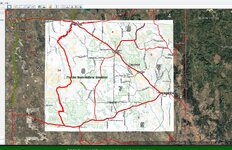
Wyoming land ownership GIS data

Neilbob

FNG
Classified Approved
Joined
Feb 19, 2024
Messages
56
Does anyone know where I can download GIS data for Wyoming public land? The hunt planner used to have a Google Earth file available for each unit, but they’ve redone the hunt planner. They link to ArcGIS open data, but I don’t see any ownership data. I have gohunt, but I like making my own maps and using different sources as well. Thanks for any help.
 
OP
Neilbob

Neilbob

FNG
Classified Approved
Joined
Feb 19, 2024
Messages
56
I searched some more and found that BLM has spatial data for "surface management agency" for the state: https://gbp-blm-egis.hub.arcgis.com/datasets/BLM-EGIS::blm-wy-surface-management-agency/about

You can download a Google Earth KML or ArcGIS data.

"The Surface Management Agency (SMA) dataset depicts Federal land in the state of Wyoming and classifies this land by its active Federal surface managing agency within the BLM Administrative State of Wyoming"

Hopefully this is helpful to someone. It sure is for me :)
 
Top