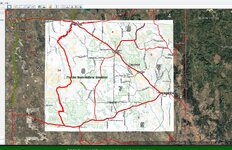
Wyoming land ownership GIS data

Neilbob

FNG
Classified Approved
Joined
Feb 19, 2024
Messages
62
Does anyone know where I can download GIS data for Wyoming public land? The hunt planner used to have a Google Earth file available for each unit, but they’ve redone the hunt planner. They link to ArcGIS open data, but I don’t see any ownership data. I have gohunt, but I like making my own maps and using different sources as well. Thanks for any help.
 
OP
Neilbob

Neilbob

FNG
Classified Approved
Joined
Feb 19, 2024
Messages
62
I searched some more and found that BLM has spatial data for "surface management agency" for the state: https://gbp-blm-egis.hub.arcgis.com/datasets/BLM-EGIS::blm-wy-surface-management-agency/about

You can download a Google Earth KML or ArcGIS data.

"The Surface Management Agency (SMA) dataset depicts Federal land in the state of Wyoming and classifies this land by its active Federal surface managing agency within the BLM Administrative State of Wyoming"

Hopefully this is helpful to someone. It sure is for me :)
 

jonesn3

Lil-Rokslider
Joined
Jan 11, 2022
Messages
280
The BLM surface ownership is probably the best option. Download as a SHP and import into Google Earth. Pretty sure that’s the source data I used when doing this myself (would have to look back to recall for sure). I would recommend loading the initial SHP file into a GIS software for viewing organizing, and reducing (at least at first, then export to GE for further use). I’ve found the sometimes it’s nicer to have the adjoining parcels combined into a large single polygon instead of every parcel line being a feature. Also, depending on the dataset, it might be a very large file and cause issues with GE. So pre-processing the data to your liking is a good step IMO.

Pretty sure this file only shows ownership type not necessarily private land ownership details (name, tax address, etc). Just agency name, local/state/federal, or private. Like I said it’s been awhile so maybe it’s different now

BLM WY GIS Portal

Other GIS Portal (includes BLM and FS datasets)
 
Top