Hunt_Jefferson
WKR
I’ve been using OnXHunt for years and recently started using CalTopo (which I don’t really like) but decided I’d make the jump into a full fledged GPS so I don’t have to keep downloading a ton of maps to my phone. I did a lot of research and bought the new “top of the line” $500 Garmin 66sr.
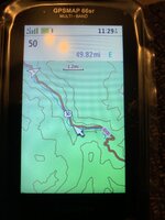
I feel like I’m back 15 years using this thing, I hate it Seriously, how is this acceptable for something released September 2020. Here are a few screenshots of ski cabin near Tahoe. At 1.2mi scale, you can’t see much and it just looks like a vast forest. No roads (besides the highway), no trails, looks kinda flat given how spread out the topo lines are.
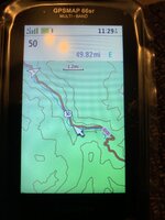
OK, let’s zoom 3 additional clicks and see what shows up. 0.3mi scale, huh, still nothing here and still doesn’t look particularly steep.
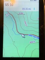
Enhance another click to 0.2mi scale. Wow, there’s roads and trails! And lots of contour lines because it’s steep as hell there!
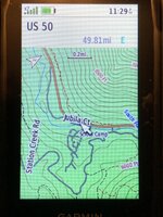
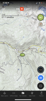
Contrast with OnX in the same area and with the same FOV as the GPS 1.2mi scale you can clearly see that there are trails and roads. You can easily tell it’s steep. No need to zoom all the way in to know that another trail is just over the next ridge or endless scrolling to see where some water might be.
I would rather buy a separate iphone and fill the whole thing up with saved maps than use this hunk of junk. What am I missing here?
I feel like I’m back 15 years using this thing, I hate it

OK, let’s zoom 3 additional clicks and see what shows up. 0.3mi scale, huh, still nothing here and still doesn’t look particularly steep.

Enhance another click to 0.2mi scale. Wow, there’s roads and trails! And lots of contour lines because it’s steep as hell there!

Contrast with OnX in the same area and with the same FOV as the GPS 1.2mi scale you can clearly see that there are trails and roads. You can easily tell it’s steep. No need to zoom all the way in to know that another trail is just over the next ridge or endless scrolling to see where some water might be.

I would rather buy a separate iphone and fill the whole thing up with saved maps than use this hunk of junk. What am I missing here?

