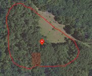
Who has the most updated satellite images?

jtivat

Lil-Rokslider
Joined
Jan 25, 2022
Location
Caledonia, MI
I have some hunting grounds in mid Michigan and none of the maps I use are showing clear cuts that are 3 years old. I have tried OnX Google Apple and none of them show the cuts.

Thanks
 
onthegomap.com

It's more made for runners, but they have updated imagery and will let you map trail distances and things like that.
 
Any idea what they were charging for that?
I don’t remember, I ask about getting better images for a bay system I fish and I remember them offering price breaks for the more you bought. I thought about turning it over to a fishing site I have a membership to for group buys, but I got busy and moved on from it.
The company (either eagle view or another business I can’t think of right now) I talked to has price breaks for memberships as well.
 
If you use Gaia, they have a map overlay called “FreshSat-Cloud Free” that has satellite imagery that’s updated every 14 days or so. Just recently used it on a hunt looking for the thick pine tree patches that white tails typically bed in here. The hardwood leaves have changed colors and dropped a good bit, so the pine tree patches really stand out this time of year.
 
How come these bigger hunting map apps can’t keep with updates, even 1-2x a month would make a huge difference. Genuinely asking as I don’t have any prior knowledge about this stuff
 
Another option?

.

w5g1s8R3c4
 
Last edited:
If you use Gaia, they have a map overlay called “FreshSat-Cloud Free” that has satellite imagery that’s updated every 14 days or so. Just recently used it on a hunt looking for the thick pine tree patches that white tails typically bed in here. The hardwood leaves have changed colors and dropped a good bit, so the pine tree patches really stand out this time of year.
Can you point me in the right direction for this overlay? I looked and can not find it
 
Can you point me in the right direction for this overlay? I looked and can not find it
Disregard, I found it. The images are not very clear. HuntStand has monthly updated satellite pics. They are way better that the GAIA
 
Spartan forge has mapping most recently updated showing last February if I remember correctly.
 
I have tried everything listed here and none have updated maps for the area I am looking for. Thanks for the suggestions but still looking.
 
Hmmmm are you updating your app regularly? Clearcuts from last year showed up for me in northern WI
 
Which app are you using?
Sorry, I use OnX. I had a similar complaint then realized that it was because i had the area I hunt downloaded for offline use, there’s an update button next to saved maps that did the trick for me
 
Back
Top