How reliable are springs on OnX as water sources in NW Wyoming? I have found a few on OnX but when I go on Google earth or any other satellite imagery I can't see anything.
Dashed lines on topos mean intermittent flow, so totally depends on snow levels, melt, how dry the year has been, etc. Same goes for most springs and some smaller streams. Also are there cattle, because they can trample/ destroy a good spring, you can still get water out of them most of the time but it tastes like shit.. Litterally. More reliable springs are dictated by terrain features. Also you can check Google Earth, for a decent idea if it's actually a spring.
So if it looks thick and green in a grassy desert it most likely has good water?
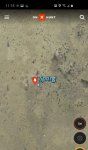
I've attached one of the "springs" from OnX. Personally I don't think I would trust them.