Live Aerial/Satellite Imagery Applications?

Joined
Mar 29, 2019
Messages
758
Do any of you have any recommendations for near real time satellite imagery sites or phone applications?

I’d even be willing to spend a few bucks a month…

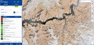
I used a site called “sentinel hub” through last spring and it was awesome to get on the ground, live snow reports. They got bought out and it’s a mess.

It was handy for spring Bear and predator hunting, as well as fishing 🤣

Appreciate any tips-
 
OP
Travis Hobbs
Joined
Mar 29, 2019
Messages
758
I should also mention, the quality of imagery is not super important, although to see if there is bared off ridges, open water, that type of thing would be awesome.

And hopefully it’s something with a fairly decent number of updates, 1-2 times a week hopefully 🤞🏻
 

nnmarcher

Lil-Rokslider
Joined
Jun 11, 2019
Messages
232
To get any aerial imagery updated that frequently, I think you would have to pay a considerable chunk of change. Maybe there is a service I am not aware of.

Exo Mtn Gear had a podcast recently where they talked to a rep from OnX who mentioned being able to buy recent images for some square mile or two at a time. I don't recall the details, but you could request a recent image of a certain piece of land and then you'd get the picture 10 days later. I think it was $50 a pop though.


def90

WKR
Joined
Aug 12, 2020
Messages
1,720
Location
Colorado
Yeah, I was going to say that that sounds like something you would have to pay a decent amount of change for.
 

wapitibob

WKR
Joined
Feb 24, 2012
Messages
5,998
Location
Bend Oregon
onx recent imagery is usa wide if you're a premium member or add the NOHRSC snow data to your google earth pro

you can also buy imagery from onx, but the area is too small
 

IdahoElk

WKR
Joined
Oct 30, 2014
Messages
2,600
Location
Hailey,ID
I should also mention, the quality of imagery is not super important, although to see if there is bared off ridges, open water, that type of thing would be awesome.

And hopefully it’s something with a fairly decent number of updates, 1-2 times a week hopefully 🤞🏻
Just curious, why 1-2x's a week?
 

prm

WKR
Joined
Mar 31, 2017
Messages
2,308
Location
No. VA
The satellites that capture good imagery do not sit in one spot (geosynchronous). The imaging satellites are orbiting (low earth orbit-LEO) and can get imagery in relatively narrow swaths each time they pass by.
 

IdahoElk

WKR
Joined
Oct 30, 2014
Messages
2,600
Location
Hailey,ID
The satellites that capture good imagery do not sit in one spot (geosynchronous). The imaging satellites are orbiting (low earth orbit-LEO) and can get imagery in relatively narrow swaths each time they pass by.
Thanks for the response, What are you trying to see with this that you can't see on OnX?
 

prm

WKR
Joined
Mar 31, 2017
Messages
2,308
Location
No. VA
Most snow data is via modeling supported with some actual data. There are new satellites that can apparently capture measure snowpack using LIDAR. That satellite is also zipping along in a low earth orbit (300-400 miles up).
 
OP
Travis Hobbs
Joined
Mar 29, 2019
Messages
758
Most snow data is via modeling supported with some actual data. There are new satellites that can apparently capture measure snowpack using LIDAR. That satellite is also zipping along in a low earth orbit (300-400 miles up).

I had heard this! Was really curious if imagery was available to the general public
 

svivian

WKR
Joined
Mar 16, 2016
Messages
3,263
Location
Colorado
Sentinel hub is the best ive found so far. Lacks a bit of detail but its the most up to date satellite imagery i can find. Takes a bit of playing around with the settings to get it to work but ive found it useful for checking burn areas, timber cuts etc...
 
OP
Travis Hobbs
Joined
Mar 29, 2019
Messages
758


So this was what I was using this spring, I could get Imagery updates nearly 2-3 times a week. And could pan around and look at images almost like google earth…. It’s completely different now.

The only option I see is update KMZ files, and they will let me know when a picture is updated? Maybe I’m doing something wrong?
 

prm

WKR
Joined
Mar 31, 2017
Messages
2,308
Location
No. VA
It wasn’t designed for snow, rather sea ice. There is data available, but I doubt it’s useful for us.

 
OP
Travis Hobbs
Joined
Mar 29, 2019
Messages
758
Sentinel hub is the best ive found so far. Lacks a bit of detail but its the most up to date satellite imagery i can find. Takes a bit of playing around with the settings to get it to work but ive found it useful for checking burn areas, timber cuts etc...
Appreciate it, I wonder if I just gotta mess with it more, I think it use to be a lot easier🤣
 

N.ID7803

WKR
Joined
Nov 25, 2020
Messages
508
Location
N. Idaho
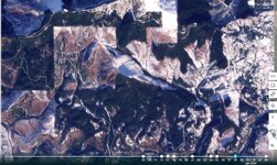
Check out Planet.com. They have daily satellite imagery. I use it quite a bit for work. It is a paid subscription but you could trial it and see if you like.
 

Attachments

  • Planet.jpg
    Planet.jpg
    329.9 KB · Views: 11

mntnguide

WKR
Joined
Apr 27, 2012
Messages
472
Location
WY
caltopo.com says they have updated daily imagery...I have not used it, so not sure how great it is. But they have great mapping layers. Looks like its $50 a year for the paid version with live imagery.
 

yak

Lil-Rokslider
Joined
Feb 9, 2014
Messages
256
Location
Windsor, CO
For live aerial imagery you can use "Zoom.Earth". It's a website that is free and will give you live images from a distance. Unfortunately, if you zoom in too close you'll notice the live imagery will shift to static, archived imagery. So it's only beneficial when glancing at an area from an airplanes' altitude. I use it to determine snow cover and get an idea of snow line.
 
Top