High cascade buck tag oregon

Joined
Jan 27, 2022
Messages
680
Hello, I drew a high cascade buck tag for Oregon this year. I was wondering if anybody had info of areas to go to get away from people and horse camps ? I’m hoping to backpack into some more remote backcountry areas. Not looking for your “ honey holes” just curious if anybody would be willing to share some pointers ? Also if you have any tips/pointers if anybody has hunter This tag before! I appreciate it!
 
Joined
Dec 5, 2019
Messages
1,146
Hello, I drew a high cascade buck tag for Oregon this year. I was wondering if anybody had info of areas to go to get away from people and horse camps ? I’m hoping to backpack into some more remote backcountry areas. Not looking for your “ honey holes” just curious if anybody would be willing to share some pointers ? Also if you have any tips/pointers if anybody has hunter This tag before! I appreciate it!
Did you do your research before putting in for the tag? Do you understand the hunt boundaries?
 

FairWeatherFisher

Lil-Rokslider
Joined
Apr 1, 2023
Messages
115
Location
Eugene, OR
“Within wilderness boundaries of Rogue-Umpqua Divide and Sky Lks Wilderness areas and beginning at Detroit; northeast on Breitenbush Rd 46 to FR 4660; east on 4660 to FR 4661; north and east on 4661 to FR 5732; north on 5732 to FR 5730; northwest on 5730 to FR 57; east on 57 to FR 58; north on 58 to FR 5850; north on 5850 to Linney Cr; north on Linney Cr to Salmon Rvr; northwest on Salmon Rvr to FR 2618; north on 2618 to Hwy 26; east and south on Hwy 26 to north boundary at Warm Springs Reservation; northwest on north reservation boundary through Bear Springs to Clear Lk Butte; west and south on the west boundary of the Confederated Tribes of the Warm Springs Reservation (CTWSRO) to the summit of Mt Jefferson; south along the west CTWSRO boundary and the Cascade crest (Jefferson/Linn Co. line) to the junction of the “crest of the Cascades” with the Pacific Crest National Scenic Trail (PCT) in T11S R8E Sec 17; then south on the PCT to Hwy 20/126 at Santiam Pass; south on Pacific Crest Trail to Southern Pacific Railroad track north of Diamond Peak; southeast on Southern Pacific Railroad track to FR 60; southwest on 60 to Pacific Crest Trail at Windigo Pass; south on Pacific Crest Trail to the boundary of Mt Thielsen Wilderness near Tolo Mt; east and south on eastern wilderness boundary to Pacific Crest Trail near Summit Rock in S36, T28S, R5-1/2E; south on Pacific Crest Trail to Hwy 138; west and north on Hwy 138 to FR 60; northeast on 60 to FR 700; northwest on 700 to FR 770; north on 770 to FR 2154; east on 2154 to FR 362; north on 362 approximately 3/4 mi to FR 2153; north on 2153 to FR 21; west and north on 21 to FR 23; northwest on 23 to FR 5875; north on 5875 to Hwy 58; west on Hwy 58 to FR 5871; north on 5871 to FR 2408; northwest on 2408 to FR 24; east on 24 to FR 1934; north on 1934 to FR 19; east and north on 19 to FR 410; south on 410 to FR 2639; east on 2639 to FR 2638; north on 2638 to Hwy 126; east on Hwy 126 to FR 2654; north on 2654 to FR 15; north on 15 to Hwy 20; west on Hwy 20 to Sheep Cr Rd (FR 2047); north and east on 2047 to FR 2266; east on 2266 to Hwy 22; north and west on Hwy 22 to Detroit, the point of beginning.”

I love how they can write this all out, but don’t outline it on a map.
 
Joined
Dec 5, 2019
Messages
1,146
“Within wilderness boundaries of Rogue-Umpqua Divide and Sky Lks Wilderness areas and beginning at Detroit; northeast on Breitenbush Rd 46 to FR 4660; east on 4660 to FR 4661; north and east on 4661 to FR 5732; north on 5732 to FR 5730; northwest on 5730 to FR 57; east on 57 to FR 58; north on 58 to FR 5850; north on 5850 to Linney Cr; north on Linney Cr to Salmon Rvr; northwest on Salmon Rvr to FR 2618; north on 2618 to Hwy 26; east and south on Hwy 26 to north boundary at Warm Springs Reservation; northwest on north reservation boundary through Bear Springs to Clear Lk Butte; west and south on the west boundary of the Confederated Tribes of the Warm Springs Reservation (CTWSRO) to the summit of Mt Jefferson; south along the west CTWSRO boundary and the Cascade crest (Jefferson/Linn Co. line) to the junction of the “crest of the Cascades” with the Pacific Crest National Scenic Trail (PCT) in T11S R8E Sec 17; then south on the PCT to Hwy 20/126 at Santiam Pass; south on Pacific Crest Trail to Southern Pacific Railroad track north of Diamond Peak; southeast on Southern Pacific Railroad track to FR 60; southwest on 60 to Pacific Crest Trail at Windigo Pass; south on Pacific Crest Trail to the boundary of Mt Thielsen Wilderness near Tolo Mt; east and south on eastern wilderness boundary to Pacific Crest Trail near Summit Rock in S36, T28S, R5-1/2E; south on Pacific Crest Trail to Hwy 138; west and north on Hwy 138 to FR 60; northeast on 60 to FR 700; northwest on 700 to FR 770; north on 770 to FR 2154; east on 2154 to FR 362; north on 362 approximately 3/4 mi to FR 2153; north on 2153 to FR 21; west and north on 21 to FR 23; northwest on 23 to FR 5875; north on 5875 to Hwy 58; west on Hwy 58 to FR 5871; north on 5871 to FR 2408; northwest on 2408 to FR 24; east on 24 to FR 1934; north on 1934 to FR 19; east and north on 19 to FR 410; south on 410 to FR 2639; east on 2639 to FR 2638; north on 2638 to Hwy 126; east on Hwy 126 to FR 2654; north on 2654 to FR 15; north on 15 to Hwy 20; west on Hwy 20 to Sheep Cr Rd (FR 2047); north and east on 2047 to FR 2266; east on 2266 to Hwy 22; north and west on Hwy 22 to Detroit, the point of beginning.”

I love how they can write this all out, but don’t outline it on a map.
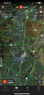
There are maps with it outlined. It’s a good tag if someone is willing to put in the work and learn the boundaries.
 
Joined
Apr 11, 2019
Messages
98
You can see the boundary on OnX. Honestly I’m not sure how I was able to get it but somehow I did. Each Ranger district will have good information on the areas you plan on going into.
 

Attachments

  • 4C68C8C6-0860-4D96-AAC6-8EF4A57F6959.jpeg
    4C68C8C6-0860-4D96-AAC6-8EF4A57F6959.jpeg
    111.2 KB · Views: 61
OP
Oregonhuntrboi
Joined
Jan 27, 2022
Messages
680
You can see the boundary on OnX. Honestly I’m not sure how I was able to get it but somehow I did. Each Ranger district will have good information on the areas you plan on going into.
Dang if you can remember how to layer that on onx for me that would be super appreciated!!
 

Diced

WKR
Joined
Dec 10, 2022
Messages
457
Most popular areas are burns high up near the crest of the cascades. It can take a serious amount of hiking to get up to where you'll need to be. Deer are there, but the bucks are incredibly elusive. To kill one you'll have to bust them out of the thick stuff or un-burnt timber. I believe the success rate on the tag is like 3-5%.

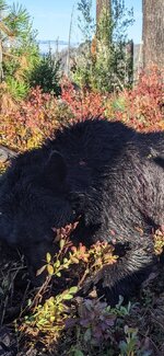
If the huckleberries are still plentiful up high you can find some big bears too. I ran into a brute in '21.
 

Attachments

  • Screenshot_20230707_222114_Photos.jpg
    Screenshot_20230707_222114_Photos.jpg
    330.5 KB · Views: 98
OP
Oregonhuntrboi
Joined
Jan 27, 2022
Messages
680
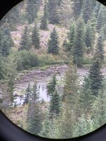
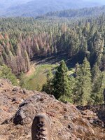
Find small, isolated and undisturbed watering locations. There will be deer using them.View attachment 573760View attachment 573761
Thanks! I found a couple isolated water spots like that but didn’t see any tracks moving to the water. I Backpacked into a desolate burn area this weekend. Most ground cover has not grown back and was just clay. Saw zero deer, and only a couple doe tracks. I’m going to try hiking into a different area next weekend. I’m used to hunting black tails on the coast but never have at these higher elevations. Any other tips for areas to target?
 
Joined
Dec 5, 2019
Messages
1,146
Thanks! I found a couple isolated water spots like that but didn’t see any tracks moving to the water. I Backpacked into a desolate burn area this weekend. Most ground cover has not grown back and was just clay. Saw zero deer, and only a couple doe tracks. I’m going to try hiking into a different area next weekend. I’m used to hunting black tails on the coast but never have at these higher elevations. Any other tips for areas to target?
I’ll be out next weekend as well with the same tag, let me know if you want to try to get together and glass up some new spots.
 

Pdzoller

WKR
Joined
Feb 27, 2021
Messages
376
Location
Oregon
Haven’t seen any bucks yet. Really haven’t had the time to dedicate myself to anything promising though. Only been able to get into areas that receive more attention than I normally would like. Good luck to everyone and post up pictures if you get one!
 
Top