GPS whats everyone using?

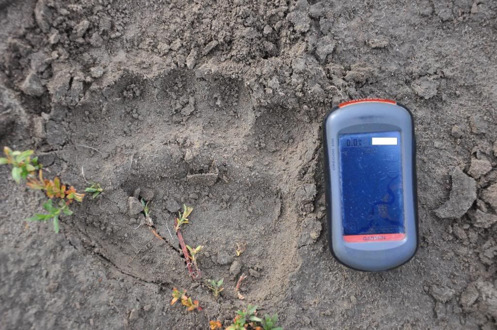
I have the Oregon 450 that i also got on a great discount. Together with the Hunting GPS map chip, it is one slick unit!

The unit and map are very accurate. On Saturday I was out looking for bears, and took a different route down from the wilderness. I was able to watch my progress as I neared the Forest Service / Private border. I could even see the property owner's name. As I approached the section corner on the border I walked until my arrow was right over the corner. I stopped, looked around, and there five feet from me in the brush was the property corner pin. That inspires confidence that you aren't going to find yourself in a bind.

I didn't know if I would really like the touch screen, but I really do! I used to have an eTrex and a Magellan model. Both worked well, but it drove me crazy scrolling through letters and symbols to name my waypoints. Now it is like typing out a text. It is really nice.

The Oregon's screen is also big enough to be enjoyable to use, but the unit itself isn't so big it gets in the way. I almost went for the Montana with its huge screen, but now I think it would just be too big.
 
This is an older Garmin Oregon 300 that I used last week on a grizzly observation. Sceen scratches are exaggerated with the camera flash. Gamin w/ huntinggps Montana chip....golden.

2-7.jpg
 
Oregan 450t got it on sale at Cabela's. So far I like it but haven't really learned all its features. love the touch screen its just like using a phone.
 
I don't need all the bells and whistles the higher priced ones come with, so I recently upgraded my 10 year old Legend to the newer color screen Legend HCx. I got it on Amazon.com for $153 with a USB cable and shipping included. That was cheaper than the old one cost! I also bought a Wyoming microSD card for land ownership and am very happy since it has the same basic system as the older one and I won't have to learn much to use it.
 
I'll second the Oregon route. Great unit. I'd only get the "t" model if it came in a price equal or less than the non "t". As mentioned, get the GPS Hunting maps for your area and don't look back. I like to get the ones downloaded to my cpu and load them on my own micro SD card on my garmin. The real advantage is that since I've bought my maps set for CO last year I've probably gotten at least 3 update emails. I'm able to download and update all from home. The chip needs to be sent back. There is a price difference with the desktop stuff being more expensive so you'll just need to weigh which option works best for you.
 
I'll second the Oregon route. Great unit. I'd only get the "t" model if it came in a price equal or less than the non "t". As mentioned, get the GPS Hunting maps for your area and don't look back. I like to get the ones downloaded to my cpu and load them on my own micro SD card on my garmin. The real advantage is that since I've bought my maps set for CO last year I've probably gotten at least 3 update emails. I'm able to download and update all from home. The chip needs to be sent back. There is a price difference with the desktop stuff being more expensive so you'll just need to weigh which option works best for you.

I've always been a map and compass guy myself and never really been "lost"...that was until last year where in the same area I was lost twice. From the maps it's a simple looking area, but I got TOTALLY turned around twice, both times out solo which I do a lot.

Gman - After some research I've had my eye on the Oregon 450 and been unsure about the "T" if I should plunk down the extra $80 for the pre-loaded topo or not. Are these pre-loaded topo maps continental US? Or regional? I'm a slow learner...so basically what you're saying is that if I plan to purchase and download the GPS Hunting Maps, which I do, then the pre-loaded maps are a total waste, even for general hiking and traveling? Found the 450T for $331 on Amazon and the 450 for $289 and thanks to Prime, either can be here in 2 days. Thanks for your input or anyone else for that matter.
 
ktcamo,

You got it. no need for the "T" (refers to total USA topo) when you use the HuntingGPSmaps cards. That is the reason I went with the non-T also.
 
A GPS is one piece of equipment I have never owned.....maybe someday.
 
The t is accurate it showed the trail we were on as a gap and it was dead on it went from pack trail to game trails to pack trail. I'm ok with that.
 
Thanks guys for the input. I'm looking forward to the new Oregon 450T set to arrive at my house on Friday. I figured for the $40 difference I could use the topo maps as I travel home (Oregon) to visit my parents or other places outside my hunting GPS maps area of Utah.
 
I use my phone. Samsung galaxy. It works pretty good for what I need. I have the back country pro for software. And a goal zero to charge it in the back country.
 
I've always been a map and compass guy myself and never really been "lost"...that was until last year where in the same area I was lost twice. From the maps it's a simple looking area, but I got TOTALLY turned around twice, both times out solo which I do a lot.

Gman - After some research I've had my eye on the Oregon 450 and been unsure about the "T" if I should plunk down the extra $80 for the pre-loaded topo or not. Are these pre-loaded topo maps continental US? Or regional? I'm a slow learner...so basically what you're saying is that if I plan to purchase and download the GPS Hunting Maps, which I do, then the pre-loaded maps are a total waste, even for general hiking and traveling? Found the 450T for $331 on Amazon and the 450 for $289 and thanks to Prime, either can be here in 2 days. Thanks for your input or anyone else for that matter.

The 450T is for the entire US. However, it's only 100k scale, where the huntinggpsmaps are 24k scale (more detail). It's nice to have the topo info when making trips and needing road/highway information. One advantage of the T is a larger internal memory. It doesn't make any sense to me why a unit with more pre-loaded data would also have more free memory, but I guess they have to find a way to justify a higher price.

I have the 450T because I got a great deal on it, but I also use huntinggpsmaps primarily for the land boundaries.
 
These guys have it all correct. The "t" maps will be nice to have if the price difference isn't much in that you'll have topos for your non-hunting gps map area. But once you install the hunting gps map for your state you won't be looking at the "t" maps.
 
Garmin Rino 530s or the newish eTrex 20. The eTrex 20 is so small and light and does everything I need without some of the bells and whistles I wouldn't need otherwise. I tried the touch screens but couldn't warm up to them, just too hard to run with gloves on.
 
A GPS is one piece of equipment I have never owned.....maybe someday.

I never hunted with one til I started hunting with some friends the last couple of years. Now I own a Rino 530 so we can talk and keep track of eachother LOL! I put the huntmapgps program on it and am pretty amazed at it for finding property lines.
 
Back
Top