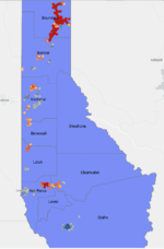
Yea it seems like an easy project idea, straight forward and relevant (i.e. lots of articles published about the idea).It looks like there is a significant amount of data on beetle kill and wildfires so I suppose I would use that to see if there is any correlation between the two and to what extent.
@Clarktar I really like the idea of doing something the landlocked public lands. Now what would a characteristic be that I could use to prioritize them? Maybe distance from an existing/potential access point (most cost effective?) Size?
The size of land would be a nice criteria to use for prioritization (most bang for buck). You could make it more complicated by trying to see if the state has any classifications or land type as it relates to certain species that overload these landlocked parcels and incorporate that into the prioritization. Also I like the idea of distance to existing road (another cost criteria).
It would be neat to come up with 2-3 ranking criteria to help you prioritize the list of parcels. You could also reach out to some NGO group to see what they might be interested in as far as ranking criteria (TRCP for example).
Sent from my SM-G973U using Tapatalk


