E-Scouting; Navigating the back country

Joined
Jul 31, 2024
Messages
27
Location
Georgia
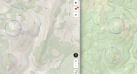
Hey, new to western hunting, heading on my first hunt this September. As I look at the terrain via topo maps, my goal is to build routes that I could take to gain access to certain areas. My fear is that some of the drainages I think are accessible may actually be impassable. Is there any ONX layers or tips that anyone could share on how to judge weather the country is too steep/rugged to access? For clarity, I will be hunting some Mesa type country.
 
Joined
Apr 7, 2021
Messages
17
Location
Oregon
Some good tips in here. Assume things will be bigger and steeper than you expect. It's pretty hard to visualize the magnitude of the terrain if you have never been out west. You could try comparing maps of the steepest local areas you know and calculating grade, but it won't be perfect. OnX has the "labs" feature that has some tools to highlight slope angle.

Make plans, but have backups, and don't blindly follow topo - it is not perfect, and can & will miss cliffs. Don't get yourself cliffed out.
 

Dave_

Lil-Rokslider
Joined
Mar 3, 2017
Messages
168
Location
Austin, TX
Hard to tell sometimes without boots on the ground. Topolines are the best indicator but they can be misleading at times. I hunted a new area in Colorado a few years ago and was cliff ed out 2-3 times where the topo maps just showed a steep gradually slope.

I like to measure (in onx or google earth) the distance and elevation gain on slopes I've climbed or tried to climb to give me an idea when e-scouting new areas i.e 1000ft up per 1mile and look at max slope. In Google earth I also change the 3d Elevation Exaggeration to about a 1.4-1.5 and it seems to match up pretty well. I also like the older USGS maps vs topo lines over an image if looking at terrain.

So again boots on the ground helps. So if you can't scout have plan B - D...

Sent from my SM-G975U using Tapatalk
 
Joined
Feb 27, 2012
Messages
2,678
Location
Tijeras NM
I've always said GE or any of the various apps do not do the mountains justice. Unfortunately you won't find that out until you are there. That's why it is so important to scout prior with boots on the ground. If all a guy does is escout, you're in for a rude awakening. So plan for it to be a lot steeper than what it looks like on OnX. If you're hunting the Grand Mesa, it's not horribly steep for the most part, but be prepared for a large crowd of people just about everywhere you go and there are some steep hikes if you aren't already on top.
 

Slick8

Lil-Rokslider
Joined
May 8, 2019
Messages
215
I'm only a few years into hunting NM after having lived there in the early 90's while in the USAF. While there in my 20's I hunted a little and back country fished a lot more.

When I picked it back up four years ago I believe my mind chose to omit the memories of how steep things are.

As stated above, the maps don't do it justice. I try to compare OnX to GE and now get a better feeling for steepness or the potential of when e-scouting.

One of the surprises for me was the steepness of the smaller hills, particularly the bottom quarter compared to even how they look from a short distance away.

If at all possible, make a trip out there now. It will not only better prepare you for the hunt but will alter your e-scouting technique.

Best of luck this fall.
 

jgilber5

Lil-Rokslider
Joined
Dec 31, 2021
Messages
177
Location
New Mexico
When using onX in the backcountry, always download the highest resolution offline maps to get the most accurate topos.
 
Joined
Feb 25, 2024
Messages
11
I'll echo what others have said on this thread. I took that 5x5 on my first DIY archery hunt in an area that on the topo didn't look all that bad but the first 250 yards up were killer at about a 35% grade, then uphill for another 1.5.

If I had e-scouted that area I wouldn't have hunted it as it didn't appear to have enough timber to hold elk for bedding but it did and it was that dark timber once you were in it. Also they were hold up in a bowl that was right next to a dirt road which got pretty heavy traffic. e-scouting would have never had me planning to hunt that spot but I had patterned their early morning movement from feed/water to bedding and I took him in the bedding area. Had to tie him off to keep him from going down hill while quartering him up.

Same trip, we e-scouted a awesome pasture area in the wilderness so we hiked in and it looked like money, elk wallows, grass, water, cover, etc. Nothing came in and the closest bugle was at least 1.5 miles away.

Hope some of this helps.
 

elkliver

WKR
Joined
Dec 25, 2018
Messages
305
Location
Oregon
If multiple TOPO lines touch to make solid shading DO not proceed! :) Usually you can tell an obvious cliff but not the smaller ones... Then Boots on the ground make the difference
 

guylaga

Lil-Rokslider
Joined
Dec 6, 2021
Messages
221
Location
West Texas
You just need to get boots on the ground before the hunt or even on the first day just check out different areas so you get a realistic idea of the terrain.

The best I have found for getting a realistic idea of the terrain is download the the google earth desktop app, and turn on elevation exaggeration to 2.

Topo lines can be misleading as stated already, what could appear to be a gradual slope to a creek will really be a 20-30 ft cliff at the bottom.

Another thing to consider is how "thick" that dark forest will be, whether it is dead fall, brush, new growth aspens or all three combined. Thats what took me by surprise the first few times out west.
 

ndbuck09

WKR
Joined
Feb 16, 2015
Messages
639
Location
Boise, ID
In my opinion, OnX topos are the worst there are out there. Onx topos soften everything and don't stack tight for steep stuff, leading you to think a slope won't be too bad. This leads you to making poor route decisions and creates overall frustration when you end up in a situation where you're going up something that is way steeper than you had thought, taking way longer. This summer was the last straw for me scouting down in colorado. So I've moved back to gaia for my main mapping system.

Gaia has a lot more basemaps than onx and the topos you can run on there are superior in a lot of ways. It just provides a better vision of the terrain overall. So I end up only using onx for the private/public info. I wish onx would just pony up and get the USGS topo map onto their system.
 

Koda_

Lil-Rokslider
Joined
Dec 24, 2023
Messages
216
Location
PNW
Lidar data will show impassable terrain that doesnt show up with topography lines.
 

Grant K

FNG
Joined
Sep 19, 2017
Messages
74
Location
Ridgway, CO
Lidar data will show impassable terrain that doesnt show up with topography lines.
if the area you are hunting has been surveyed by Lidar you can't beat it for showing all the tiny terrain features that will screw you over, plus it usually is detailed enough to show the little sneaks through cliff bands...
I'd suggest using slope shading more in the field as Lidar is pretty data intensive, but if you have a route in mind you can definitely confirm if it goes, some friends and I have even been able to predict the difficulty of ice climbs with it...

I'd also be in the camp of using Gaia or Caltopo instead of OnX for mapping, there isn't a worse basemap available IMO, I still have it for ease of sharing waypoints with everyone else who has it but I never actually use it for navigating.
 

Koda_

Lil-Rokslider
Joined
Dec 24, 2023
Messages
216
Location
PNW
if the area you are hunting has been surveyed by Lidar you can't beat it for showing all the tiny terrain features that will screw you over, plus it usually is detailed enough to show the little sneaks through cliff bands...
I'd suggest using slope shading more in the field as Lidar is pretty data intensive, but if you have a route in mind you can definitely confirm if it goes, some friends and I have even been able to predict the difficulty of ice climbs with it...

I'd also be in the camp of using Gaia or Caltopo instead of OnX for mapping, there isn't a worse basemap available IMO, I still have it for ease of sharing waypoints with everyone else who has it but I never actually use it for navigating.
Its true not everywhere has lidar data but its been super useful for escouting routes.
I know onx is popular with hunters but I use Caltopo exclusively now I could never go back. I can draw a route using lidar in their MapBuilder topo layer on my computer, and it just shows up on my phone app in the field. Such a great mapping product.
 
Joined
May 25, 2022
Messages
41
Location
Idaho
I'm now wondering if I'm missing out on something? Screenshot below is the topo map I see in OnX (left) and Gaia (right). Are people using "USGS Topo" in Gaia instead of the "Gaia Topo (feet)" layer? Maybe the preference is for Premium layers (I have a free/basic membership).

I'm not seeing many (if any) differences in the actual topo lines/structure between these, appears to be more of a difference in styling between the platforms.
 

Attachments

  • onx_vs_gaia.png
    onx_vs_gaia.png
    1.9 MB · Views: 28

Koda_

Lil-Rokslider
Joined
Dec 24, 2023
Messages
216
Location
PNW
Here is a screenshot of the Caltopo app from my phone, showing lidar data under the Caltopos basic MapBuilder Topo map (free) layer.

You can see how the lodar data really highlights even the smallest gullys to avoid in that north aspect slope...

Screenshot_20240814_140709_CalTopo.jpg
 
Joined
Jul 30, 2015
Messages
6,106
Location
Lenexa, KS
Use the slope shading feature to check steepness. Yellow is moderate, red is steep, purple is very steep.

This is good advice, but as with anything you can't totally trust the tools. I know areas that show up as red that you would need climbing gear to ascend. I think generally the yellow and tan are navigable.
 
Joined
Aug 14, 2016
Messages
1,506
Location
Great Falls MT
Check the topo lines. Just remember you might be able to rock a miles out with ease on a treadmill or whatever but a mountain mile is basically two normal miles. Unless you're Cam Hanes. Then if there's deadfall or brush it'll slow you way down.

Also usually it's not best to go full Dora the explorer either. You may do more harm than good. Lost calf calls as you go and move slowly.
 
OP
jermlacey12
Joined
Jul 31, 2024
Messages
27
Location
Georgia
This is good advice, but as with anything you can't totally trust the tools. I know areas that show up as red that you would need climbing gear to ascend. I think generally the yellow and tan are navigable.
When it comes to the vegetation, any tips on online scouting to get an idea of what is on the landscape? Call a biologist?
 
Top