Do you trust OnX?

Would trust OnX over any watch/step counter, more accurate. If you sit and move your arm around that carries the watch/fitbit it'll show you as taking steps, whereas OnX measures by actual distance.
 
ONX has been reliable for tracking distances during our backpack treks and long hikes.
During seven day, eighty mile trek through Thorofare, ONX track mileages were very close to what I had plotted on map and researched, expecially for distances between designated campsites.
Most importantly, ONX marked my location six miles, two thousand feet above the Missouri in the Gates Wilderness so that Two Bear Air could fly directly to me from Kalispell and snatch my sorry arse off the mountain when I broke my knee! So I am a real fan of Two Bear Air and ONX!
 
The reason I ask this question is because of what I've found from our last years hunt. My son in law kept track of his steps/ millage on his FitBit watch on all our hunts. I kept track of our miles thru OnX tracks. We had 8 hunts. This is the the comparison between OnX and his FitBit and the difference.

day 1) OnX track 7.2 FitBit 9.8 2.6 diff

day 2) OnX track 4 FitBit 5.22 1.22 diff

day 3} OnX track 3.3 FitBit 4.38 1.08 diff

day 4} OnX track 7.7 Fit Bit 10.06 2.36 diff

day 5} OnX track 6.4 FitBit 10.04 3.64 diff

day 6 } OnX track 8.3 FitBit 13.53 5.23 diff

day 7} OnX track 8.1 FitBit 10.2 2.1 diff

Day 8} OnX track 8.1 FitBit 11.13 3.3 diff

I even laid a path over the OnX tracks and they were pretty close between the two. Going forward I'm thinking of adding about 20-30% to my planned hunt paths on OnX. Is there a more accurate way to figure hunt path miles?
Not sure about the miles but OnX is so useful in so many other ways you will be running it anyways. I think elevation and switchbacks are probably causing lower mileage. I just know a mile in the mountains is way longer than a mile in my neighborhood!
 
Thanks all for the advice and opinions. This will help me in planning our hunt routes in the future. I will trust OnX when I plan our routes and add a mile or so to be safe, Thanks again
 
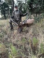
I killed a New Mexico bull in 2024, public draw tag, on private property without written permission, legally. Without ONX Hunt it would not have happened. We got out of the truck to hunt National Forest but heard 3 bulls across the road on private property as we exited the truck to hunt. The app showed that the landowner had opted for unit wide ranch authorizations for tags and in NM that land is then open to public hunting, without prior consent or written permission. As a courtesy we went to the ranch house and informed them of our decision to hunt there as we were hearing 3 bulls soft talking while bedded above a cattle waterer. The landowner thanked us for informing her of our intentions and said they would make sure they did not interfere with our hunt. ONX also showed the water source pinpointing where we set up and 2 hours later we had a different bull come in bugling. ONX distance numbers were precise compared to my rangefinder and gave elevation change for the shot also. With Apple Auto or Android Auto it can be displayed on a vehicle screen, for driving area roads near hunting spots. I will never hunt w/o it again, even though I always carry a Garmin GPS. IMG_6386.jpg
 
Would never trust an app for accurate traveled mileage.

I switched to BaseMap several years ago but haven't ever tried to use for tracking a route.
 
Giving a lick about which is more miles or not is pretty elementary. Hunt. Figured out the Android versus Apple discrepancy?
Knowing how far something is can be quite helpful. When scouting I will track different mileage and is helpful when hunt planning. It's not that uncommon that I will but 40+ miles hiking in a weekend of scouting. The difference between packing out a large animal 6 miles vs 10 miles can be quite a bit.. Start time to be to a glassing point before sun up will be different if I'm going 4 miles or 6. If you aren't interested why post? These tools do a lot more than just show land ownership boundaries. I'm able to identify food sources, cover, water, travel corridors, road/trail access, elevation gain, distances and so much more.

Do you actually have any data to back up your claims that apps like OnX have led to overuse? Lots of activities have grown in popularity.

You honestly just sound like a boomer that doesn't understand new technology... Why are you on here commenting about something you apparently don't care for? Hunt.
 
I've tracked backpacking trips on well established trails. I also used it to track many mountain runs when training for ultra marathons. Have tracked 1000s of miles on apple watches, fitbits, OnX, traced on google earth, AllTrails and more. OnX does very well imo, especially if I only use it while moving. If I leave it tracking for a substantial amount of time while stopped, it'll add some fake distance. I have also tracked it while driving and the distance usually aligns very closely with my cars odometer.

All that to say I would trust it more than your buddies wrist device.
 
I will recant to some extent. All Trails is the app I have the most problem with. In my small town in the Front Range of Colorado, there was so much overuse during covid and has continued where paid parking has been implemented, pets are not allowed on the trails to our local reservoirs etc.

With that, apps that make $$ hand over fist for people who own them lead to overuse. OnX may or may not be in the same league. However I think it's a fair progression of logic that leads to the conclusion Onyx doesn't help the situation, and the usage/ permitted entry regulations and laws, hunting or otherwise are changing in Colorado because of it (too many people in the woods).

I will add that a good topo map shows everything with respect to where water would be, forested areas versus open areas would be etc.
 
Last edited:
I will recant to some extent. All Trails is the app I have the most problem with. In my small town in the Front Range of Colorado, there was so much overuse during covid and has continued where paid parking has been implemented, pets are not allowed on the trails to our local reservoirs etc. So yes, apps lead to overuse. OnX may or may not be in the same league however I think it's a fair progression of logic that leads to that conclusion that Onyx doesn't help the situation, and the laws are changing in Colorado because of it.
All Trails being free definitely contributes to it users. Over 65 million. OnX is less than 10% of that. I think Covid certainly had a lot of impact on the increased use as indoor activities were shut down so people were outdoors that otherwise wouldn't have been.

I think another major issue with the front range (I went to Mines so spent 4 years in Golden) is just the population growth. CO population has doubled since 1990, mostly is the front range. That's an extra 3 million people within a fairly short drive from a limited number of access points. My wife was born and raised in CO and we used to plan on moving back but there's just too many people there now... Maybe we'd go to the western side of the state.
 
Western side of the state is a good plan if you come back. My little town was pretty much developed when we moved here 30 years ago, just not space to build. But everything east of the interstate is building up and it's hurting the quality of life for a lot of people with respect to water and dry summers, traffic on the roads that were never meant for this many people, same things that happen in all the good places to live. Everybody wants to come there and that's that.
 
All Trails being free definitely contributes to it users. Over 65 million. OnX is less than 10% of that. I think Covid certainly had a lot of impact on the increased use as indoor activities were shut down so people were outdoors that otherwise wouldn't have been.

I think another major issue with the front range (I went to Mines so spent 4 years in Golden) is just the population growth. CO population has doubled since 1990, mostly is the front range. That's an extra 3 million people within a fairly short drive from a limited number of access points. My wife was born and raised in CO and we used to plan on moving back but there's just too many people there now... Maybe we'd go to the western side of the state.
OnX has a lower number of users however if you look at the hunting population, I bet it's higher among the population of hunters than All Trails is with respect to the general population. Again, I don't have the numbers, my logic would say that is a fair possibility.
 
OnX has a lower number of users however if you look at the hunting population, I bet it's higher among the population of hunters than All Trails is with respect to the general population. Again, I don't have the numbers to back it up but the logic to me would say that a fair possibility.
Certainly true. About 4 million OnX users to 16 million hunters is ~25%. Less than 10% of all Americans use All Trails. But there are wayyy more non-hunters than hunters. Which is why I see more non-hunters in the field than I do hunters.. Hunters are also much more seasonal. Between skiing, snow shoeing, snowmobiles, hikers, mountain bikers etc. the woods are getting human impact constantly. However I'm not sure what kind of solution there is. Not allow people to go outdoors?
 
OnX has a lower number of users however if you look at the hunting population, I bet it's higher among the population of hunters than All Trails is with respect to the general population. Again, I don't have the numbers, my logic would say that is a fair possibility.
There’s OnX backcountry that’s the non hunting version that is really popular. So many businesses use OnX such as surveying companies, utility companies etc. I would bet OnX has the most users at this point.
 
We both know there isn't a solution. One of the great things about this country is freedom. However things are typically on a pendulum. Swings one way and becomes deemed too far then it comes back the other way. But never hits the threshold of how it was, and always swings toward the previous threshold extreme and exceeds it, comes back, but never quite as far as it just passed the high water mark. I can't think of anything that hasn't been that way.
 
Thanks for that. If OnX has more users, that's eye-opening.

With respect to maps and boundary lines, does OnX have their own Imaging system or is it basically using Google Earth and overlaying property lines on it? From what I understand with the amount of area to cover, Google Earth every 3 years has a full cycle. Data could be 3 years old.
 
There’s OnX backcountry that’s the non hunting version that is really popular. So many businesses use OnX such as surveying companies, utility companies etc. I would bet OnX has the most users at this point.
All publicly released data indicates all trails has more.
Total social media following higher for all trails as well.
AllTrails is freely accessible where as many of OnX tools require payment.
OnX users may be more serious and certain communities will definitely have more OnX users (hunting community for example), but in terms of total user count, AllTrails appears to have had more.
AllTrails has become the gold standard for free hiking apps, and number of hikers dwarfs the number of hunters..
 
Back
Top