Sierra Hunter
WKR
- Joined
- Feb 28, 2021
- Messages
- 945
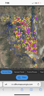
Just saw this posted for antelope which I believe is the first species of an ongoing project. They’ve created a map of where everyone harvested their goats. Are we the first state to do this or has this happened before? It always felt wrong answering where you harvested a game animal on the tag and this brings that message home. https://cdfw.maps.arcgis.com/apps/dashboards/76817a519cc446bdb1cd0ecbc82487dc
.jpeg")