Toprut No Longer Hosting Google Earth/KMZ Files

jonesn3

Lil-Rokslider
Joined
Jan 11, 2022
Messages
242
It looks like TopRut is no longer providing files for Google Earth (KMZ files) due to relationship with OnX. What's the next best option?

The "Unit Maps" tab on the Toprut webpage simply redirects you to OnX Maps.

I wish I would have downloaded all the unit datasets last year instead of only the half dozen or so for a particular region of interest. Does anybody have a Google Drive or Dropbox link they'd be willing to share the RAW Toprut KMZ files if they have them saved? I would be willing to do the same for the handful of Idaho units I have saved (again, just the raw files from Toprut).
 
OP
J

jonesn3

Lil-Rokslider
Joined
Jan 11, 2022
Messages
242
Yes, if permanent that really sucks. However, I will say that I seemed to rely on Toprut KMZ files mostly for the best quality game unit boundary and public land layers. I get contours, roads, fire layers, and more from other sources. So maybe not as dire a situation as I thought initially.

I was able to find a decent and seemingly accurate public land layer for several states at DIY Hunt Maps: https://diyhuntingmaps.com/p/google-earth-hunting-file-downloads.html . I am sure there are better offerings elsewhere utilizing ESRI Shapefiles or whatnot. The DIY unit boundaries layer they offer was not great and did not appear complete. So, I went through the painful process of creating my own KMZ for unit boundaries, elk zone, and unit/zone labels. It took a few hours last night but worth it in the long run.
 

Maverick1

WKR
Joined
Jun 1, 2013
Messages
1,838
TTT. Anyone know of a place that has similar information to the datasets once hosted/supplied by TopRut? (Yes, the information is "out there" - somewhere - but collecting it from the different sources would take some time. Looking to import into GE, information such as roads, unit boundaries, etc.)
@wapitibob
 
OP
J

jonesn3

Lil-Rokslider
Joined
Jan 11, 2022
Messages
242
Treeline Academy (aka. Mark Livesay) just launched a Google Earth toolkit for ID, CO, MT, and WY. This looks to be what Maverick1 was looking for as a one stop shop for all data in GE. There is a fee though, and I’m unclear if that limits your usage of the data year after year if you don’t pay for a continuing membership. I plan on trying it out but can’t offer a review yet. If it’s anything like Marks E-Scouting course, this should be really good.
 
Joined
Apr 24, 2021
Messages
40
I had the same question so glad you asked it here. I have about 15 Idaho unit KMZs downloaded from TopRut into GE before they stopped offering them. I'll show you mine if you show me yours!
 
Joined
Jan 4, 2020
Messages
17
Bummer that @onX Hunt removed TopRut maps. Luckily downloaded quite a few in the areas I hunt, but these were a great resource for trying to learn new units. Not everything needs to be commercialized....
 

Brendan

WKR
Joined
Aug 27, 2013
Messages
3,875
Location
Massachusetts
For what it's worth, I looked at a bunch of Toprut maps last year and immediately found 3-4 with out of date and inaccurate boundaries. So there was also the aspect that they stopped investing in keeping them accurate, and if I don't trust them for that I don't want them at all. And, this was the biggest reason I kept an OnX subscription, so this was a good reminder to cancel and make sure it doesn't renew. Draw odds and unit research has always been better in GoHunt than Toprut too.

As far as mapping: I'm still a fan of Gaia over OnX anyways, I can get all of the Google Earth Datasets there and unit maps. I know they're not owned by a "Hunting Company" which matters for some, but Outside+ gets me a hell of a lot for a lot less $$$.

Still looking for a GE based solution as I prefer that, but I'll use Gaia as it's what I use in the field and just load waypoints in there until I find something.
 

wapitibob

WKR
Joined
Feb 24, 2012
Messages
5,922
Location
Bend Oregon
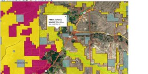
I use GE pro for 90% of my scouting. Back in the day before they renamed to onX you could get their plat4GE GE overlays. I grabbed a bunch of states and occasionally use those for private land, gov land, and walk in areas. I have most if not all western states, 2013 and 2014 so the land owners may not be current but you'll use your map app for that anyway. Shoot me a msg if you need some and I'll email.
You will unzip the file, I use state specific hunting folders, then open in GE. There will be a file name "open first", that's the file you open in GE after you extract.


1 (Small).jpg


You should be able to get updated unit boundary overlays from the individual states game dept. A cpl states also have wildlife location/use area/corridor stuff too.


wapitibob

WKR
Joined
Feb 24, 2012
Messages
5,922
Location
Bend Oregon
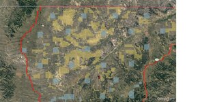
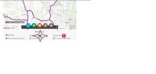
If you hunt WY, you can download KMZ files from the GE links for hunt areas or Deer regions. Some areas have KMZ but many don't. Most Deer regions are set up. Data is comprised of hunt area bndry and gov land.

2 (Small).jpg

3 (Small).jpg
 
OP
J

jonesn3

Lil-Rokslider
Joined
Jan 11, 2022
Messages
242
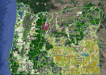
With no longer having the free Toprut file access, I went through the effort of creating my own GE state map dataset starting with the state-published land ownership layers. So far I have done this for OR, WA, NV, CA, ID, AZ, and NM. Although the data sets aren't perfect, particularly when it comes to private land ownership metadata (just focused on the public land and gov land), it has already been really useful. I still double check my datasets to at least one mapping platform to confirm ownership and roads. My GE datasets include public land, state hunting access properties (aka. block management), wilderness, historical fires, recreation, water/springs, gates, and road and trails. The effort upfront is somewhat significant, but the best part is the data is free and reusable year after year.

Capture.JPG

OnX is quickly losing my favor in the hunting-map mobile app space. The removal of Toprut GE files hasn't made me any more pleased with their platform. GoHunt seems to be doing a lot and adding key features, and creating a "one stop shop" for all the info, planning, maps, and gear. I'm also liking Gaia and using CalTopo more and more. OnX, on the otherhand, limits you to downloading 5-10 mile wide tiles for offline use and limits you to 1500 markups/waypoint features on your account. I'm excited about their Apple CarPlay or Android Auto feature now, tho.

Wapitibob - I would be interested in those GE files you mentioned!
 
Top