Road Access

CB4

WKR
Joined
Oct 10, 2018
Messages
515
Location
Iowa
What is the most reliable online service to determine road acess?

The area I am E scouting shows a certain road has access all the way to the national forest but there are a few post online from hunters in prior years stating the road is gated off. I have only found 1 online GIS map that shows it does not have access. Basemap, Onx, and Gaia all say it does.

I do plan on calling and talk to game wardens and local biologist.
 

wytx

WKR
Joined
Feb 2, 2017
Messages
2,312
Location
Wyoming
In Wyoming we contact the Road and Bridge Dept for each county, they take care of the public roads in each county. They usual;ly have a map of public roads.
 

Weldor

WKR
Joined
Apr 20, 2022
Messages
1,829
Location
z
Any recent satelite or aerial photo's should show a gate or gates. I have had to call the FS before to have them unlock gates that they locked for unknown reason's. It takes awhile no easy chore.
 

NMJM

FNG
Joined
Aug 2, 2022
Messages
75
Location
New Mexico
It really depends on the state. In New Mexico, county commissions can close county roads that run through private property. It can be a huge pain the ass. I have seen roads that have been open for decades closed because a land owner petitions the county commission. Sometimes the land owner is on the county commission. The problem is complicated by the way land owner tags are issued and the huge increase in the price of those tags over the last few years. Closing a road to the public can make those tags even more valuable. The short answer is it is very difficult to determine if a county road going through private land is open or closed in New Mexico.
 

WCB

WKR
Joined
Jun 12, 2019
Messages
3,638
contact the county and get their roads map and call the FWP. Getting county information or forest service road map hasn't failed me yet. Anything that is 3rd party like Base Map or OnX is not IMO the official ruling per say.
 
Joined
May 1, 2018
Messages
61
Location
North Dakota
On a related note, one thing that I have a hard time understanding is how county roads can be closed to the public. The area I hunt in CO has multiple roads listed on their maps as county roads and are physically marked with signs stating CR such and such. However, a couple of these roads now have gates across them, say no trespassing, and are marked on OnX as closed to public travel but are also listed on Onx as CRs.
 

Oldrifle

FNG
Joined
Oct 25, 2022
Messages
31
Contact the county, obtain a road map, and then call the FWP to see whether it is a legal access road.
 

idahodave

WKR
Joined
Jan 2, 2019
Messages
436
Location
Boise, ID
Assuming USFS land, call the associated Ranger district and ask for a copy of their MVUM.

THAT is the legal document for what is or isn’t open, and what seasonal restrictions may apply.

Dave
 
Joined
Mar 29, 2019
Messages
729
I would recommend contacting county. There are so many roads that appear private, even marked that way that are indeed, public rights of way or county roads.
 

wytx

WKR
Joined
Feb 2, 2017
Messages
2,312
Location
Wyoming
Assuming USFS land, call the associated Ranger district and ask for a copy of their MVUM.

THAT is the legal document for what is or isn’t open, and what seasonal restrictions may apply.

Dave
If it is a FS road and not a county road, the county knows what they maintain as public.
The MVUM is a great map to have, for free too.
 

rclouse79

WKR
Joined
Dec 10, 2019
Messages
1,879
One place I hunted had a public road go through private. The land owner put up a bunch of “Warning- Active Shooting Range” and targets all along the road. Didn’t stop me and I killed an elk that day.
 

Johnny Tyndall

Lil-Rokslider
Joined
Nov 17, 2021
Messages
219
Location
MT
My understanding is that if it's a county road you have legal access. Only definitive source I've found for that is a map from the county itself. Easier in the more populous counties.

Of course, people can try to gate legal roads. I doubt that happens too much (the county theoretically maintains their roads), but I don't know of any map that would show that.

Edit: this is for roads through private land. On the FS you want the MVUM, don't know what the BLM equivalent is.
 

mtnbound

WKR
Joined
Nov 8, 2016
Messages
424
Location
N. Idaho
What is the most reliable online service to determine road acess?

The area I am E scouting shows a certain road has access all the way to the national forest but there are a few post online from hunters in prior years stating the road is gated off. I have only found 1 online GIS map that shows it does not have access. Basemap, Onx, and Gaia all say it does.

I do plan on calling and talk to game wardens and local biologist.
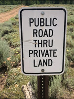
Figure out who manages the land, the Forest Service, the State, etc., and call that agency. If it's FS, you need to confirm things with the Motor Vehicle Use Map of the area.
 
Top