I went on my first high country mule deer hunt this year and had the same questions. The following is something I wrote up documenting my process. It seemed to work pretty well as I was able to find deer where I'd thought they'd be...
There are some great tools out there to get a handle on where to hunt without ever leaving your home. Google Earth, topo maps, satellite imagery, etc will all help you find areas that look good to hunt. But for someone who has only a limited amount of time in the mountains, and who has never really scouted the mountains from home, this can be a daunting task. What does a basin look like? How do I know this basin will hold deer? What would make one basin better than another? These are questions running through my head...it also doesn't help that often times Google Earth uses imagery from different times of the year...so finding that lush, green summer basin isn't always a guarantee.
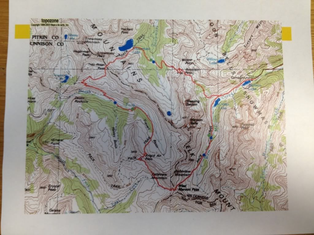
To narrow down where I wanted to focus, I started with a topo map of what seems to be the "core" area of my hunting unit.
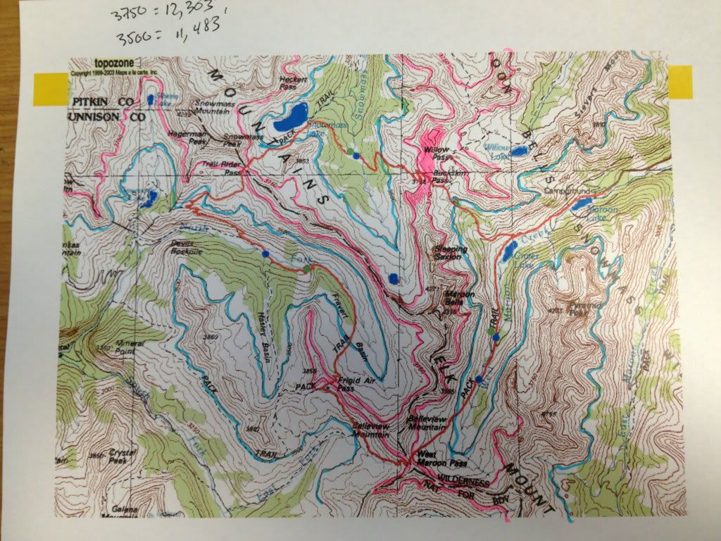
Knowing that I wanted to focus on the "high country", I needed a way to highlight areas that were in that 11,000-12,000' range and above...and that's just what I did. I took two highlighters and brought out the inner 5-year old in me. On my topomap (that I found online off of a random website), the 3,500 meter line showed up as a bolder line than the other elevation contour lines. Same with the 3,750 meter line. As 3,500 meters and 3,750 meters correlate to 11,483' and 12,303' respectively, I wanted to shade only those areas to give me an idea where to focus. I started by outlining those contour lines on the map.
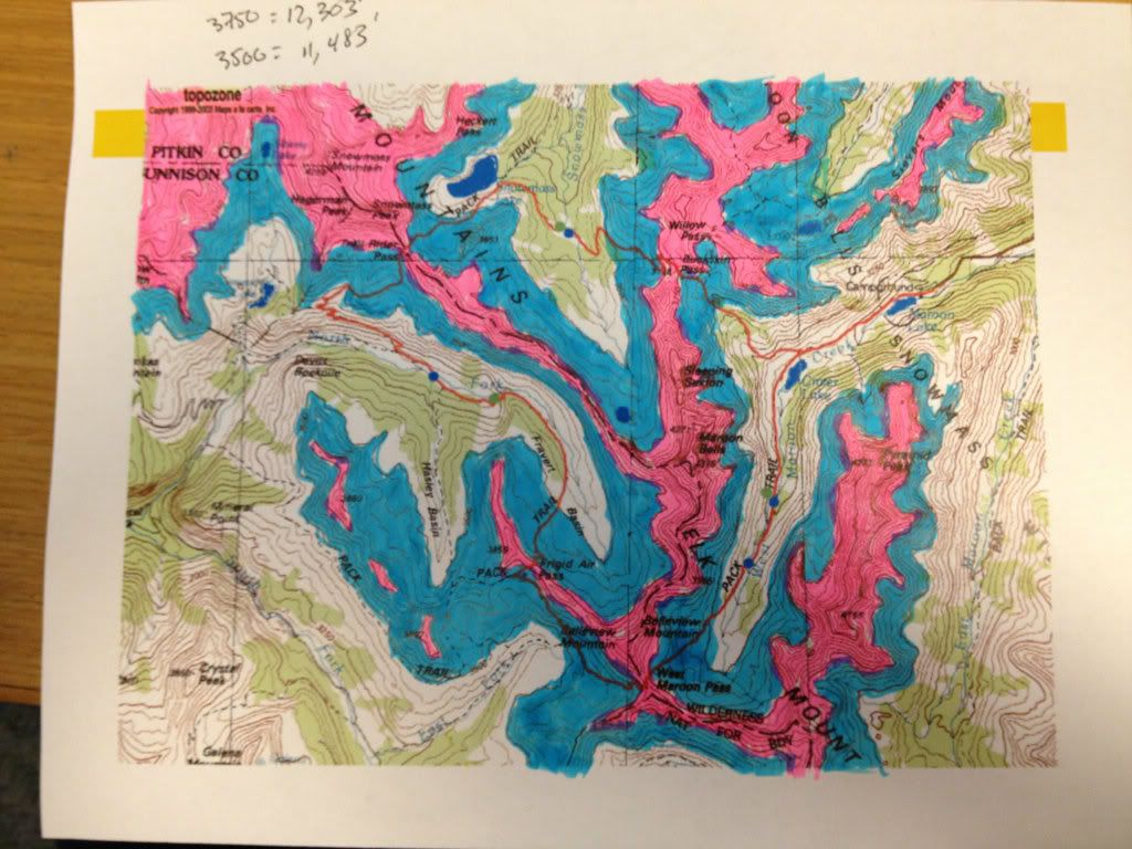
The next step was shading in the map. I shaded the area between 3,500 meters and 3,750 meters blue and areas above 3,750 meters pink. I used two colors to try and break it up and see where really high steep areas were. The plan will likely be to hunt high but focus the search in the areas at the convergence of the pink and blue lines (12,303'). Here's the map shaded in.
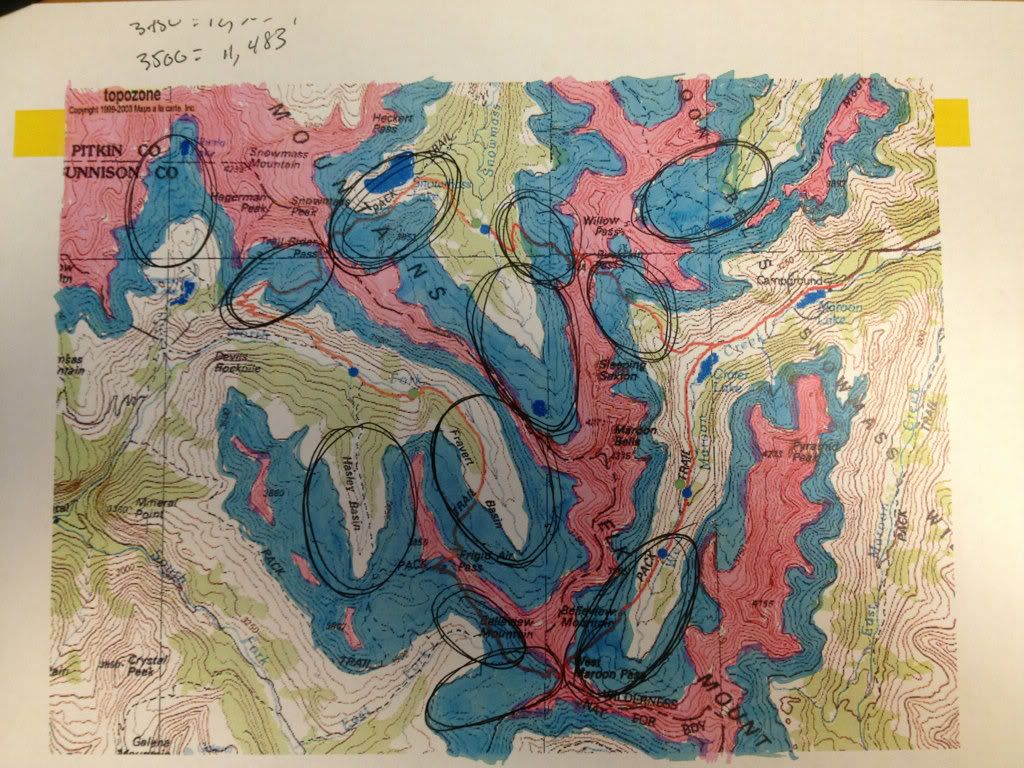
You'll notice now that the basins really jump out at you, as do passes (which are essentially at the heads of drainages and basins). With this information, I've circled some of what appear to be the more promising basins to focus my time.
I then spent some time on Google Earth familiarizing myself with those shaded in areas and picked a spot to hunt based on the combination of using all of these tools. Hope this helped some.