- Banned
- #1
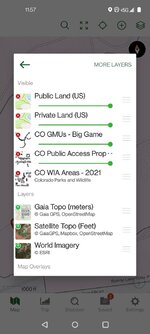
I see public and private land displays, but how to download maps to your GPS (GAIA for me) with boundaries of WIA for pheasant/quail. Alof of times if seems only portions of a farmers land are designated WIA and I'd like to have a boundary on my GPS vs solely relying on posted signs, just to be on the safe side

