Best Mapping Service in 2023?

R_burg

WKR
Joined
Dec 15, 2016
Messages
472
Location
AZ
Hey guys - I've been using Gaia for about 7 years now. My 5 year subscription is about to be up, so I need to look into what to do going forward. Back when I made this decision, it was pretty much just Gaia or OnX, and it seemed like more people around here liked Gaia. I do hunt/use mapping in multiple states, so I want the entire US.

These days there are tons of options: Gaia, OnX, BaseMaps, GoHunt - and a host of others. Where do things stand these days? Are any leaps and bounds better? Any features one has another doesn't that I'd really be missing out on?

I will say it annoys me that OnX broke off into 3 services. I use Gaia for off-roading too, and I will need a separate subscription for that in OnX. That's dumb, and starts to be fairly expensive vs the competition (IMO).


PS: I did search, I didn't see a thread on this since 2021 or so. If there is a big thread comparing them I apologize, please point me to it.
 

BBob

WKR
Joined
Jun 29, 2020
Messages
4,661
Location
Southern AZ
Most I know are still on OnX. I have both Gaia and OnX. Gaia for drilling down into layers for more detailed info and OnX for quick and dirty and it’s what friends send pins to me on. I’ve used GoHunt but don’t really go back to it much. 3D still seems a bit glitchy. I do use the online GoHunt for some info though, that and mostly Google Earth.
 
Last edited:

wapitibob

WKR
Joined
Feb 24, 2012
Messages
6,042
Location
Bend Oregon
GE Pro is the best for desktop, there are only two I'd look at for the phone, OnX and Gaia.

If you leave your phone in service mode and move in/out of service while hunting, Gaia will be the better choice. OnX can hang up when service is lost.
Gaia "may" also a better choice if you have a massive amount of waypoints/tracks and use a Samsung phone. I have seen OnX issues when those conditions are present although it was a year ago.
 
OP
R

R_burg

WKR
Joined
Dec 15, 2016
Messages
472
Location
AZ
GE Pro is the best for desktop, there are only two I'd look at for the phone, OnX and Gaia.

If you leave your phone in service mode and move in/out of service while hunting, Gaia will be the better choice. OnX can hang up when service is lost.
Gaia "may" also a better choice if you have a massive amount of waypoints/tracks and use a Samsung phone. I have seen OnX issues when those conditions are present although it was a year ago.

Yeah I still use GE Pro on the desktop, side by side with Gaia usually. I do leave my phone in airplane a lot when hunting.

Sounds like there are still some Gaia users, even though I dont see many threads on it here.
 
Joined
May 9, 2022
Messages
4
I don’t think any one app does it all great have to use google earth along with whatever other app you choose, OnX and lotsa google earth for me
 
OP
R

R_burg

WKR
Joined
Dec 15, 2016
Messages
472
Location
AZ
Thanks guys - judging by the overall lack of responses I would guess not much has changed in the past few years. Guess I will probably stick with Gaia.
 

nnmarcher

Lil-Rokslider
Joined
Jun 11, 2019
Messages
237
I would suggest looking at CalTopo. There are some nice layer options and it seems like the paid levels of subscription get you pretty cool features instead of just access to more states. I've found the road and trail network to be accurate and I love being able to make my own map and print it. I don't have any experience with Gaia, but I prefer Caltopo to OnX. OnX has the benefit that all my friends use it so sharing waypoints is a lot easier. I also haven't used OnX in a while so maybe their features are advancing.

@Mojave, I use CalTopo in Europe but I can't speak to Africa. It has kicked butt compared to some of the other mapping options here.
 
OP
R

R_burg

WKR
Joined
Dec 15, 2016
Messages
472
Location
AZ
I would suggest looking at CalTopo. There are some nice layer options and it seems like the paid levels of subscription get you pretty cool features instead of just access to more states. I've found the road and trail network to be accurate and I love being able to make my own map and print it. I don't have any experience with Gaia, but I prefer Caltopo to OnX. OnX has the benefit that all my friends use it so sharing waypoints is a lot easier. I also haven't used OnX in a while so maybe their features are advancing.

@Mojave, I use CalTopo in Europe but I can't speak to Africa. It has kicked butt compared to some of the other mapping options here.

People love Cal Topo that use it - don't a lot of people use it for sailing and those types of activities?

I never really looked into it for hunting because I don't think it has unit maps and the like, but admittedly I haven't looked at it in ~18 months.
 

nnmarcher

Lil-Rokslider
Joined
Jun 11, 2019
Messages
237
People love Cal Topo that use it - don't a lot of people use it for sailing and those types of activities?

I never really looked into it for hunting because I don't think it has unit maps and the like, but admittedly I haven't looked at it in ~18 months.
Good question, I'm actually not sure who their primary audience is. I don't think it is built as specifically for hunters as something like OnX or GoHunt.

I don't know that it has unit maps and a quick google didn't give me the answer. Maybe with a little creativity you could import that data as a layer. If you are interested, this is a decent video highlighting some of CalTopo's features: https://www.traditionaloutdoors.com/2018/08/14/caltopovideo/.
 

PSDBowhunter

Lil-Rokslider
Joined
Feb 6, 2018
Messages
132
Location
Trout Run, PA
I went through this process earlier this year, mainly in an effort to clean up all the apps on my phone. I had OnX, Spartan Forge, Basemap, Gaia, Huntwise, Huntstand, GoHunt, and Caltopo all on my phone. Long story short, I kept coming back to OnX for simplicity and great off leaf imagery for the main areas I hunt. Some of that could be a matter of being the most familiar with OnX, but I used the others on and off over the past few years.

In addition to OnX, I did keep the Caltopo app as well. I really enjoy making maps on their desktop version and have their paid subscription.

I essentially narrowed it down to one hunting specific app and one general mapping app.

With the ever changing technology and cost of technology it's a good to look around every couple of years.
 

pumaa7

FNG
Joined
Aug 9, 2023
Messages
12
Gaia & google earth pro for desktop scouting. OnX user interface much better for cell phone use in the field. For western hunting I really like running everything to dive deep on the escouting. Mark livesay course very useful
 
Joined
Jan 3, 2020
Messages
1,074
Location
Becker Ridge, Alaska
Most I know are still on OnX. I have both Gaia and OnX. Gaia for drilling down into layers for more detailed info and OnX for quick and dirty and it’s what friends send pins to me on. I’ve used GoHunt but don’t really go back to it much. 3D still seems a bit glitchy. I do use the online GoHunt for some info though, that and mostly Google Earth.
I also have both and prefer Gai as I can store waypoints in a hierarchy of folders like AK/moose/2022 MT/pheasant/easternMT/2022, etc.
and the marker symbology and labeling is much better in Gaia.
High resolution satellite imagery appears clearer in Gaia compared to OnX.
I also like the lower price covering all the states as I hunt AK and MT.

The one thing I do use OnX for is to find the location of Block Management form boxes in MT Block Management Areas.
 

360

FNG
Joined
Aug 26, 2023
Messages
15
Most I know are still on OnX. I have both Gaia and OnX.
Even though my issues are with OnX backcountry, the problems I cover in this topic pretty much applies to all OnX software.

I have the most up to date version of this on my phone and I can tell everyone that
Onx backcountry is useless for planning anything and never should have been released in it's unfinished condition Even though this video is 2 years old, Look at the date of my comment here because the problems I list below are from the current download of it.

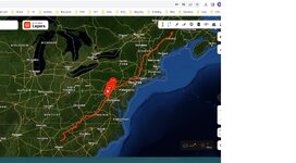
This app has no glossary and no legend/key (Here is an example of what I'm talking about):
The map shows undefined red, black, blue, and green lines (The legend/key is specifically designed to define things that are on a map)
Aside from the many colored lines not being defined, there are multiple clusters of them on the map, no one would ever know what cluster to go to.

____________________________________________________________________________________________________

In it's current state, There is no way to plan a thru-hike using this because it doesn't have any premapped routes for things such as the Appalachian Trail. Regardless of what version the app is (Free or paid), Typing in Appalachian Trail, should automatically show me the entire trail line from Georgia/Maine. What's even more ridiculous, is how there is no suggestion that denotes the starting/end points within Georgia/Maine.

The reality for someone planning a thru-Hike of the AT with this is that a person would be able to finish the entire hike of the AT before they would ever be able to finish a thru-hike plan route for the AT.

Since a person is required to their own research in order to do any type of planning, that means the individual planning would be someone who would not only have to know the entire layout of the AT and everything on it and in between which would include all towns, names, camping spots, parks, hostels..etc..which is not only not feasible but it's outright unacceptable.

OnX should be ashamed of themselves for releasing this unfinished app in the condition. The 7 day trial is literally a free 7 day use of what they claim is the premium version (So you are being shown what you get before you shell out money) the problem is that the 7 day free trial can barely do anything listed in what it shows the premium version is supposed to have/do. 3/4 of the features listed in the premium version either don't work or aren't in the 7 day trial which they should be. But right now $30 for an unfinished app that you cannot even check out the premium options, is silly. No one is going to fork over $30 when an individual cannot even test the premium options that are supposed to be in the trial in order to make a decision to invest $30

This is absolutely idiotic and Onx backcountry should be ashamed of themselves never should have been released in it's unfinished condition
 

Bootaka

FNG
Joined
Aug 11, 2023
Messages
18
I used a custom map through an app called Maverick for 10 years. I still use since it has complete NOAA charts for my boats. I ran onx the last couple years out in the woods and across the US, it is ok. property lines was the only thing I really waned it for.

Gaia is having a sale ATM for their premium "outside" so I picked up that as well. I'm liking that much more than onx so far.
 

wapitibob

WKR
Joined
Feb 24, 2012
Messages
6,042
Location
Bend Oregon
Even though my issues are with OnX backcountry, the problems I cover in this topic pretty much applies to all OnX software.

I have the most up to date version of this on my phone and I can tell everyone that
Onx backcountry is useless for planning anything and never should have been released in it's unfinished condition Even though this video is 2 years old, Look at the date of my comment here because the problems I list below are from the current download of it.

This app has no glossary and no legend/key (Here is an example of what I'm talking about):
The map shows undefined red, black, blue, and green lines (The legend/key is specifically designed to define things that are on a map)
Aside from the many colored lines not being defined, there are multiple clusters of them on the map, no one would ever know what cluster to go to.

____________________________________________________________________________________________________

In it's current state, There is no way to plan a thru-hike using this because it doesn't have any premapped routes for things such as the Appalachian Trail. Regardless of what version the app is (Free or paid), Typing in Appalachian Trail, should automatically show me the entire trail line from Georgia/Maine. What's even more ridiculous, is how there is no suggestion that denotes the starting/end points within Georgia/Maine.

The reality for someone planning a thru-Hike of the AT with this is that a person would be able to finish the entire hike of the AT before they would ever be able to finish a thru-hike plan route for the AT.

Since a person is required to their own research in order to do any type of planning, that means the individual planning would be someone who would not only have to know the entire layout of the AT and everything on it and in between which would include all towns, names, camping spots, parks, hostels..etc..which is not only not feasible but it's outright unacceptable.

OnX should be ashamed of themselves for releasing this unfinished app in the condition. The 7 day trial is literally a free 7 day use of what they claim is the premium version (So you are being shown what you get before you shell out money) the problem is that the 7 day free trial can barely do anything listed in what it shows the premium version is supposed to have/do. 3/4 of the features listed in the premium version either don't work or aren't in the 7 day trial which they should be. But right now $30 for an unfinished app that you cannot even check out the premium options, is silly. No one is going to fork over $30 when an individual cannot even test the premium options that are supposed to be in the trial in order to make a decision to invest $30

This is absolutely idiotic and Onx backcountry should be ashamed of themselves never should have been released in it's unfinished condition


took all of 60 seconds

Untitled.jpg
 

Brendan

WKR
Joined
Aug 27, 2013
Messages
3,888
Location
Massachusetts
Still Gaia for me.

I've used Caltopo for desktop scouting to get layers into GE Desktop, but it's never been designed to compete with OnX / Gaia.
 
Joined
Dec 14, 2020
Messages
385
Bumping this back up, I have used Gaia now for a few years with no complaints. My buddy has gohunt. My question is more geared toward the accuracy of the property lines and boundaries. I’ve noticed with Gaia that my property lines and public land lines don’t line up very well where I’ll be hunting. Has anyone compared the accuracy of these two layers to the actual lines? Has anyone found any discrepancies between the mapping app and actual lines/corners. I know not everything is perfect with these apps, but I’d like to feel confident in what I’m looking at. Also, say you are trying to recover a wounded animal that crosses the line. Gaia isn’t great for landowner info, would onx be preferred here? What all info is given with landowners? Thanks in advance and best wishes.
 
Top