You are using an out of date browser. It may not display this or other websites correctly.
You should upgrade or use an alternative browser.
You should upgrade or use an alternative browser.
Wyoming maps
- Thread starter North mo.
- Start date
bmrfish
WKR
- Joined
- Aug 15, 2015
- Messages
- 334
BLM office
Sent from my iPhone using Tapatalk
Sent from my iPhone using Tapatalk
TrueAt1stLight
Lil-Rokslider
County assessor.
ClearCreek
WKR
Road and Bridge Dept for each county. BLM and topo maps also but they will show all roads and some are private
While Road and Bridge Dept. maps can be useful, in my county the R&B Dept. has roads on their GIS layer that are not public roads. They keep these roads on the GIS layer for first responders, fire fighters, etc. to use.
ClearCreek
wapitibob
WKR
There isn’t a single source for public access roads.
Exactly, email the superintendent for the county Road and Bridge and they will tell you which are in fact public roads.While Road and Bridge Dept. maps can be useful, in my county the R&B Dept. has roads on their GIS layer that are not public roads. They keep these roads on the GIS layer for first responders, fire fighters, etc. to use.
ClearCreek
ClearCreek
WKR
Would you post the actual link to this site.There is a GIS website for WY public roads - you can google it.
Just googling "Wyoming Public Roads" does not give a map of public roads, several other maps, but none that actually show public roads.
ClearCreek
Rieckman
Lil-Rokslider
ArcGIS Web Application
 www.arcgis.com
There should be a layer or setting to turn on in order to see the public roads. Some counties/cities will have their own GIS website.
hawkman71
Lil-Rokslider
- Joined
- Nov 5, 2021
- Messages
- 223
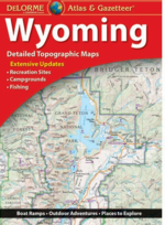
I'm a Google Maps/Earth guy but I've always enjoyed an atlas, especially the state atlases from DeLorme, so I bought a Wyoming one off eBay for like $6. I could see it extremely valuable for passengers on the trip out and for prepping this winter.
Examples from Google. The map example is from NM. I noticed on mine that a lot of roads are labelled BLM ###.
I could take a pic from mine of any place you want. It's in the truck right now, though.


Examples from Google. The map example is from NM. I noticed on mine that a lot of roads are labelled BLM ###.
I could take a pic from mine of any place you want. It's in the truck right now, though.


Dos Perros
WKR
I'm a Google Maps/Earth guy but I've always enjoyed an atlas, especially the state atlases from DeLorme, so I bought a Wyoming one off eBay for like $6. I could see it extremely valuable for passengers on the trip out and for prepping this winter.
Examples from Google. The map example is from NM. I noticed on mine that a lot of roads are labelled BLM ###.
I could take a pic from mine of any place you want. It's in the truck right now, though.
View attachment 346485
View attachment 346486
You might as an alternative consider Benchmark maps.
Wyoming Road & Recreation Atlas - Benchmark Maps
<div id=product-component-1707323685355></div> Grand Teton & Yellowstone National Parks are the heart of the American Rockies, but there is much more to Wyoming! Experience the wild spirit of The Cowboy State with Benchmark''s Wyoming Road & Recreation Atlas. No other map product can better...
www.benchmarkmaps.com
I have found them to be much more reliable at depicting public vs private roads/trails.
Similar threads
- Replies
- 8
- Views
- 441
- Replies
- 4
- Views
- 275
Featured Video
Stats
Latest Articles
-
TT#42 Mark Denham with Outdoorsmans history and innovations.
-
Kryptek Traverse Merino Review
-
First Lite 308 Pant Review
-
Argali Selway 6P Tent Review
-
AGC Kobuk 2800 Backpack Review
-
Hunting The Leaf-off Window
-
TT#41 Jordan Budd’s Tips on Finding and Killing the Big One
-
NEMO Hornet Elite Osmo 1P Tent Review
-
Rokcast Reload: Stories from a Wall Tent
-
Vote No On Prop. 127
