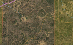
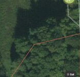
I won a lifetime elite membership with OnX several years ago and I run it religiously in the backcountry. I’ve very rarely found discrepancies with private/govt land boundaries. However, I have come upon a location where I’m confused. I’ve found an area, which I know is bordering private land, it has a long straight cleared lane approximately 1-2 miles long (like you would fence) over several ridges. The East I have assumed was private. The West side being public.
Here’s my issue. OnX shows the line 3-400 yards further East than what I’m seeing in the field. I checked GoHunt’s data, exactly the same as OnX. The USGS topo map I have isn’t detailed enough for that small of a difference. Right now, im being smart and staying West of the visual line. I should add that there isn’t any signage or paint along this line. But I’ve let several nice bulls go due to this issue. My question…Is OnX and Gohunt using the same information? Any advice on how to verify? Could the line actually be further to the East and maybe I’ve encountered a fire break type situation?
Here’s my issue. OnX shows the line 3-400 yards further East than what I’m seeing in the field. I checked GoHunt’s data, exactly the same as OnX. The USGS topo map I have isn’t detailed enough for that small of a difference. Right now, im being smart and staying West of the visual line. I should add that there isn’t any signage or paint along this line. But I’ve let several nice bulls go due to this issue. My question…Is OnX and Gohunt using the same information? Any advice on how to verify? Could the line actually be further to the East and maybe I’ve encountered a fire break type situation?


