Finding Water on Go Hunt

J.flanagan

Lil-Rokslider
Joined
Oct 10, 2022
Messages
295
I'm "e-scouting" an area I've never been to and I will not have the opportunity to go there ahead of time for actual in person scouting, and im trying to pick some potential camp locations based on water availability. GoHunt has a overlay filter that shows streams/rivers/springs. My question is, how much of that is seasonal and dictated by snow and storm run off and how much of it is there year round? I've hiked plenty but never camped while I hunt. Water is a little bit of a concern for me and I want to make sure to base my self out of somewhere that has at least some water.

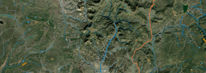
I'm going to include a screenshot that shows the hash mark blue line and then the solid blue line. The blue lines I believe are "rivers" and the hash lines are "streams." Anyway of knowing if there will be likely be water at any of these locations mid November?map.png
 
Joined
Aug 11, 2017
Messages
2,458
Location
Florida
Check on google earth, you can go through the satellite imagery history and pick different months/years and get an idea sometimes. In the big drainages you can assume some amount will be running, but on springs and creeks it changes from year to year, just have to check when you get there.
Another option if they are named creeks, get in touch with the local warden or FS and ask.
 
Joined
May 26, 2022
Messages
303
When we went Archery hunting in Southern Colorado this year 90% of the creeks I marked on OnX were dry. So definitely take any water sources on E-Scouting with a grain of salt. The only thing we could really trust were beaver dams.
 
OP
J

J.flanagan

Lil-Rokslider
Joined
Oct 10, 2022
Messages
295
When we went Archery hunting in Southern Colorado this year 90% of the creeks I marked on OnX were dry. So definitely take any water sources on E-Scouting with a grain of salt. The only thing we could really trust were beaver dams.
Are dams marked? Or you just saw them from the satellite image?
 
Joined
May 26, 2022
Messages
303
Are dams marked? Or you just saw them from the satellite image?
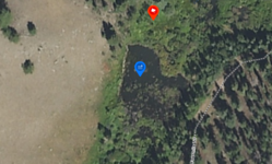
I have never seen it marked. The trick is to zoom in and follow a watercourse and look for little 'ponds' that have a defined line on the downstream side where the dam is. Here is an example of one we sat at for about 8 hours but didnt see anything:

1666822872421.png
 

dcopher

Lil-Rokslider
Joined
Oct 16, 2014
Messages
109
I believe that dashed lines are seasonal flows and solid lines are year round flows, but you might want to confirm that. I know that in other mapping programs that is true.
 
Top