


")
Western hunt planning season is upon us, and BaseMap has jumped into the hunt planning mix with a robust mobile hunt planner. Available on iOS and Android devices, the hunt planner is integrated into BaseMap’s mobile mapping app. This allows users to turn on and off map layers while using the hunt planner. It’s also full featured on mobile devices meaning you can plan hunts anywhere you have service (but please not in church)! With hunt planning integrated into the mapping app, users can check trailheads, wilderness areas, public and private land boundaries, 1 meter lidar and any of BaseMap’s other layers before settling on hunts to apply for.
State Coverage & Hunt Types

The hunt planner covers all western states, including Alaska. It also covers Kansas, Nebraska, Missouri, and Texas. More states are in the works but likely won’t be released until Fall 2025. While some hunt planners only provide coverage on limited drawings, BaseMap’s hunt planner covers over-the-counter hunts as well. This makes it easy to develop an OTC backup plan for the year if you get skunked in the limited draw. Both resident and nonresident hunt opportunities are covered, as well as youth opportunities in many states. Click here to check it out.
Filtering Capabilities

BaseMap’s hunt planner provides robust filtering capabilities, allowing the user to filter on any of the following criteria:
- Weapon Type
- Season
- Sex
- Harvest Success
- Draw Odds
- Trophy Potential
- Public Land %
Draw odds filters cover all draw types such as random draw, preference points or max bonus point, bonus point and raffle. The draw odds filter has visual cues to help you understand how the filter is being applied. In most states 2nd choice odds are available in the filter section as well.
Map Layer Integration
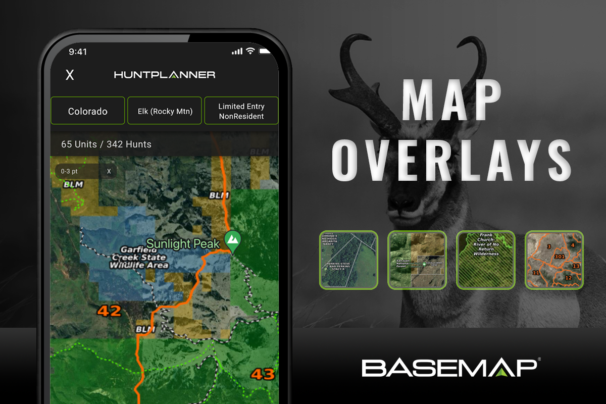
By using map layers, you can further refine hunt selections. If you want to hunt wilderness areas, old burns, units with minimal trail/road coverage or just check the slope angle at nearby trailheads, the integration with mapping layers makes this a breeze.
Often times a unit may appear to have a reasonable amount of public land to hunt but viewing public and private land boundaries as well as road overlays might highlight that access to public land is difficult. With integrated map layers, this type of research is easy to do.
Sorting Functionality
 Users can toggle between a map view and list view. The list view allows you to view hunts at either a unit level or hunt level. Within the list view, you can sort or rank units and hunts by different criteria. Sorting can help users narrow in on a handful of hunts that best fit their criteria.
Unit Details
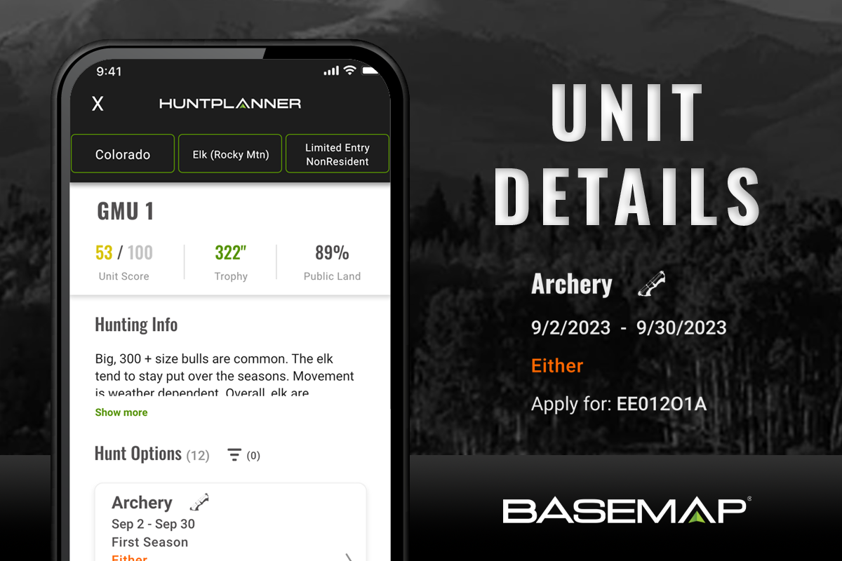
Users can view unit details by clicking a unit on the map or selecting a unit from the list view. The unit card shows the percent of public land, the trophy potential for the species (if available) and an overall score for the unit composed of 9 criteria.
Many units have a description of hunting info that provides information about access, terrain and details on where to hunt. If no filtering has been applied, all available hunts for a species in the unit will be shown. If filters have been applied, only the hunts fitting the filtering criteria will be shown. Any of the hunt cards can be clicked on to see detailed hunt information.
Hunt Details

Individual hunt details can be seen by either clicking on a hunt from the list view or from within a unit card. All hunts contain information on the legal weapon, dates and sex. The hunt code or apply for code needed for filling out an application (if limited draw) will also be shown.

For a limited draw hunt several graphs and an odds by point table (where applicable) are shown . If you’ve applied a point filter, the table will highlight your point selection showing odds at that point level. Several graphs will be populated showing historical points needed to draw and odds at the selected point level. For randomly drawn hunts or 2nd, 3rd or 4th choice hunts, the graphs will show the odds for the different choice rounds.

For both limited drawing and over the counter hunts, historical harvest statistics are shown for the hunt. Depending on the harvest survey used by the state for the particular species, statistics on harvest success rates, total number of hunters, harvest by sex, average days hunted and others are available.
Upcoming Features
A desktop version of the hunt planner is actively being developed and should be released later in the Spring or Summer. Customer feedback is always welcome and, given this is the first iteration, we encourage users to let us know what additional filters or features they’d like added to the hunt planner.
Use promo code HUNT30 through the BaseMap website to get 30% off an Ultimate Plan that includes the hunt planner.
Comment or ask Matt questions here.


